Area Overview for W12 7ET
Photos of W12 7ET
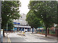
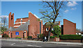

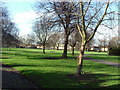
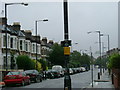
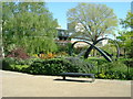
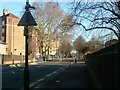
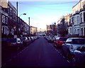
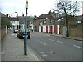

100 photos from this area
Area Information
Key information about the W12 7ET including its size, population, and administrative classification.
- Area Type
- Postcode
- Area Size
- 2526 m²
- Population
- 1665
- Population Density
- 14453 people/km²
House Prices in W12 7ET
25
Properties
£623,250
Average Sold Price
£91,000
Lowest Price
£1,125,000
Highest Price
Showing 25 properties
| Address | Type | Beds | Baths | Last Sale Price | Last Sale Date | |
|---|---|---|---|---|---|---|
| 42 Abdale Road, London, W12 7ET | Terraced | 4 | 2 | £1,115,000 | Sep 2023 | |
| 40 Abdale Road, London, W12 7ET | house | 4 | 2 | £1,080,000 | Dec 2022 | |
| 14 Abdale Road, London, W12 7ET | Terraced | 3 | 3 | £1,125,000 | Aug 2022 | |
| 24 Abdale Road, London, W12 7ET | Terraced | 4 | 1 | £1,055,000 | Feb 2022 | |
| 22 Abdale Road, London, W12 7ET | Terraced | - | - | £390,000 | Sep 2021 | |
| 8 Abdale Road, London, W12 7ET | house | 2 | - | £890,000 | Jun 2021 | |
| 38 Abdale Road, London, W12 7ET | Terraced | - | - | £485,000 | May 2004 | |
| 32 Abdale Road, London, W12 7ET | Terraced | 3 | 1 | £415,000 | Apr 2004 | |
| 36 Abdale Road, London, W12 7ET | house | 3 | - | £345,000 | Jun 2002 | |
| 26 Abdale Road, London, W12 7ET | Terraced | - | - | £360,000 | Apr 2002 |
Page 1 of 3
Energy Efficiency in W12 7ET
Amenities
Schools
| Rank | School | Type | Entry gender | Ages |
|---|
Explore more schools in this area
Go to Schools tabDemographics
Household Size
One person
most common
Accommodation Type
Flats
most common
Tenure
33
majority
Ethnic Group
White
most common
Religion
N/A
most common
Household Composition
N/A
most common
Age
47
median
Adults (30-64 years)
most common
Household Deprivation
N/A
with no deprivation
NS-SEC
46
in Lower managerial occupations
Explore more demographic insights in this area
Go to Demographics tabPlanning
Planning Constraints
- Flood RiskPremium
- Ramsar Wetland SitesPremium
- Area of Outstanding Natural BeautyPremium
- Protected Nature ReservePremium
- Protected WoodlandPremium