Area Overview for W12 0LL
Photos of W12 0LL
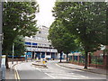
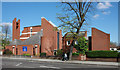

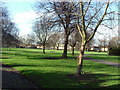
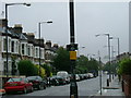

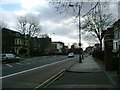
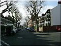
100 photos from this area
Area Information
Key information about the W12 0LL including its size, population, and administrative classification.
- Area Type
- Postcode
- Area Size
- 9527 m²
- Population
- 1575
- Population Density
- 11745 people/km²
House Prices in W12 0LL
32
Properties
£795,077
Average Sold Price
£381,000
Lowest Price
£1,215,000
Highest Price
Showing 32 properties
| Address | Type | Beds | Baths | Last Sale Price | Last Sale Date | |
|---|---|---|---|---|---|---|
| 4 Aycliffe Road, London, W12 0LL | Terraced | 3 | 1 | £1,030,000 | Oct 2024 | |
| 44 Aycliffe Road, London, W12 0LL | Terraced | 5 | 2 | £1,215,000 | Jul 2024 | |
| 10 Aycliffe Road, London, W12 0LL | Terraced | 5 | 2 | £1,145,000 | Dec 2022 | |
| 26 Aycliffe Road, London, W12 0LL | house | 4 | 3 | £1,100,000 | Oct 2022 | |
| 46 Aycliffe Road, London, W12 0LL | house | - | - | £1,000,000 | May 2021 | |
| 32 Aycliffe Road, London, W12 0LL | house | - | - | £960,000 | Nov 2017 | |
| 36 Aycliffe Road, London, W12 0LL | house | 3 | 1 | £1,020,000 | Mar 2016 | |
| 8 Aycliffe Road, London, W12 0LL | Terraced | - | - | £460,000 | Jul 2007 | |
| 2 Aycliffe Road, London, W12 0LL | Terraced | 4 | 2 | £610,000 | Aug 2006 | |
| 12 Aycliffe Road, London, W12 0LL | Terraced | - | - | £500,000 | Jul 2006 |
Page 1 of 4
Energy Efficiency in W12 0LL
Amenities
Schools
| Rank | School | Type | Entry gender | Ages |
|---|
Explore more schools in this area
Go to Schools tabDemographics
Household Size
Family (3-5 people)
most common
Accommodation Type
Flats
most common
Tenure
38
majority
Ethnic Group
White
most common
Religion
N/A
most common
Household Composition
N/A
most common
Age
47
median
Adults (30-64 years)
most common
Household Deprivation
N/A
with no deprivation
NS-SEC
35
in Lower managerial occupations
Explore more demographic insights in this area
Go to Demographics tabPlanning
Planning Constraints
- Flood RiskPremium
- Ramsar Wetland SitesPremium
- Area of Outstanding Natural BeautyPremium
- Protected Nature ReservePremium
- Protected WoodlandPremium