Area Overview for W12 0JX
Photos of W12 0JX
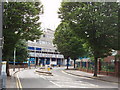
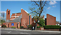

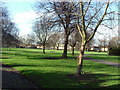
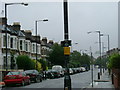


100 photos from this area
Area Information
Key information about the W12 0JX including its size, population, and administrative classification.
- Area Type
- Postcode
- Area Size
- 4416 m²
- Population
- 1794
- Population Density
- 22246 people/km²
House Prices in W12 0JX
60
Properties
£403,868
Average Sold Price
£17,500
Lowest Price
£780,000
Highest Price
Showing 60 properties
| Address | Type | Beds | Baths | Last Sale Price | Last Sale Date | |
|---|---|---|---|---|---|---|
| 81A Adelaide Grove, London, W12 0JX | Flat | 3 | 2 | £780,000 | Sep 2025 | |
| 69A Adelaide Grove, London, W12 0JX | Flat | 3 | 1 | £590,000 | Jun 2025 | |
| 65 Adelaide Grove, London, W12 0JX | Flat | 2 | 1 | £531,000 | Mar 2025 | |
| 101 Adelaide Grove, London, W12 0JX | Flat | 2 | 2 | £560,000 | May 2024 | |
| 85 Adelaide Grove, London, W12 0JX | Flat | - | - | £17,500 | Mar 2024 | |
| 79 Adelaide Grove, London, W12 0JX | Flat | - | - | £60,000 | Jul 2023 | |
| 69 Adelaide Grove, London, W12 0JX | Flat | 2 | 1 | £602,000 | Dec 2022 | |
| 81 Adelaide Grove, London, W12 0JX | Flat | - | - | £650,000 | Apr 2022 | |
| 85A Adelaide Grove, London, W12 0JX | Flat | 1 | 1 | £340,000 | Mar 2022 | |
| 67A Adelaide Grove, London, W12 0JX | Maisonette | - | - | £618,000 | Jul 2021 |
Page 1 of 6
Energy Efficiency in W12 0JX
Amenities
Schools
| Rank | School | Type | Entry gender | Ages |
|---|
Explore more schools in this area
Go to Schools tabDemographics
Household Size
Family (3-5 people)
most common
Accommodation Type
Flats
most common
Tenure
33
majority
Ethnic Group
White
most common
Religion
N/A
most common
Household Composition
N/A
most common
Age
47
median
Adults (30-64 years)
most common
Household Deprivation
N/A
with no deprivation
NS-SEC
48
in Lower managerial occupations
Explore more demographic insights in this area
Go to Demographics tabPlanning
Planning Constraints
- Flood RiskPremium
- Ramsar Wetland SitesPremium
- Area of Outstanding Natural BeautyPremium
- Protected Nature ReservePremium
- Protected WoodlandPremium