Area Overview for W11 1BN
Photos of W11 1BN


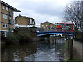
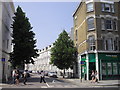

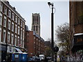


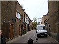
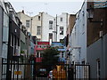


100 photos from this area
Area Information
Key information about the W11 1BN including its size, population, and administrative classification.
- Area Type
- Postcode
- Area Size
- 4468 m²
- Population
- 1234
- Population Density
- 23152 people/km²
House Prices in W11 1BN
70
Properties
£946,111
Average Sold Price
£135,000
Lowest Price
£2,300,000
Highest Price
Showing 70 properties
| Address | Type | Beds | Baths | Last Sale Price | Last Sale Date | |
|---|---|---|---|---|---|---|
| 53A Aldridge Road Villas, City Of Westminster, London, W11 1BN | Flat | - | - | £1,175,000 | Jan 2024 | |
| 19A Aldridge Road Villas, City Of Westminster, London, W11 1BN | Flat | 2 | 1 | £315,000 | Jul 2023 | |
| 23A Aldridge Road Villas, City Of Westminster, London, W11 1BN | Flat | 2 | 1 | £1,300,000 | Feb 2021 | |
| 41A Aldridge Road Villas, City Of Westminster, London, W11 1BN | Flat | - | - | £1,450,000 | Oct 2018 | |
| 43A Aldridge Road Villas, City Of Westminster, London, W11 1BN | Flat | 1 | 1 | £685,000 | Oct 2017 | |
| Flat B, 37 Aldridge Road Villas, City Of Westminster, London, W11 1BN | Flat | - | - | £2,300,000 | Oct 2005 | |
| 37 Aldridge Road Villas, City Of Westminster, London, W11 1BN | house | 5 | - | £430,000 | Nov 2001 | |
| 25 Aldridge Road Villas, City Of Westminster, London, W11 1BN | house | 4 | 3 | £725,000 | Oct 2000 | |
| Flat C, 23 Aldridge Road Villas, City Of Westminster, London, W11 1BN | Flat | 3 | 2 | £135,000 | Apr 1999 | |
| 39D Aldridge Road Villas, Westbourne, London, W11 1BN | Flat | 4 | 2 | - | - |
Page 1 of 7
Energy Efficiency in W11 1BN
Amenities
Schools
| Rank | School | Type | Entry gender | Ages |
|---|
Explore more schools in this area
Go to Schools tabDemographics
Household Size
One person
most common
Accommodation Type
Flats
most common
Tenure
20
majority
Ethnic Group
White
most common
Religion
N/A
most common
Household Composition
N/A
most common
Age
47
median
Adults (30-64 years)
most common
Household Deprivation
N/A
with no deprivation
NS-SEC
28
in Lower managerial occupations
Explore more demographic insights in this area
Go to Demographics tabPlanning
Planning Constraints
- Flood RiskPremium
- Ramsar Wetland SitesPremium
- Area of Outstanding Natural BeautyPremium
- Protected Nature ReservePremium
- Protected WoodlandPremium