Area Overview for W10 6NE
Photos of W10 6NE
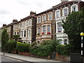
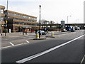
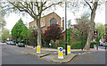
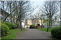
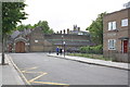
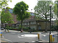
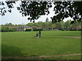
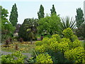
100 photos from this area
Area Information
Key information about the W10 6NE including its size, population, and administrative classification.
- Area Type
- Postcode
- Area Size
- 1.4 hectares
- Population
- 2186
- Population Density
- 13020 people/km²
House Prices in W10 6NE
60
Properties
£1,050,167
Average Sold Price
£75,000
Lowest Price
£2,000,000
Highest Price
Showing 60 properties
| Address | Type | Beds | Baths | Last Sale Price | Last Sale Date | |
|---|---|---|---|---|---|---|
| 155 Oxford Gardens, London, W10 6NE | house | - | - | £1,825,000 | Oct 2021 | |
| 147 Oxford Gardens, London, W10 6NE | Terraced | 4 | 3 | £1,680,000 | Jun 2021 | |
| 163 Oxford Gardens, London, W10 6NE | house | 4 | 2 | £1,867,500 | Apr 2018 | |
| 157 Oxford Gardens, London, W10 6NE | Detached | 4 | 3 | £1,500,000 | Aug 2016 | |
| 171 Oxford Gardens, London, W10 6NE | Semi-detached | 4 | - | £2,000,000 | Dec 2015 | |
| 165 Oxford Gardens, London, W10 6NE | Terraced | 3 | 2 | £1,310,000 | Jun 2013 | |
| 161 Oxford Gardens, London, W10 6NE | house | - | - | £825,000 | Aug 2009 | |
| 173 Oxford Gardens, London, W10 6NE | Terraced | - | - | £600,000 | Jan 2006 | |
| 135 Oxford Gardens, London, W10 6NE | house | 3 | - | £595,000 | Dec 2003 | |
| 141 Oxford Gardens, London, W10 6NE | Terraced | 4 | 3 | £75,000 | Jun 2000 |
Page 1 of 6
Energy Efficiency in W10 6NE
Amenities
Schools
| Rank | School | Type | Entry gender | Ages |
|---|
Explore more schools in this area
Go to Schools tabDemographics
Household Size
Family (3-5 people)
most common
Accommodation Type
Flats
most common
Tenure
21
majority
Ethnic Group
White
most common
Religion
N/A
most common
Household Composition
N/A
most common
Age
47
median
Adults (30-64 years)
most common
Household Deprivation
N/A
with no deprivation
NS-SEC
29
in Lower managerial occupations
Explore more demographic insights in this area
Go to Demographics tabPlanning
Planning Constraints
- Flood RiskPremium
- Ramsar Wetland SitesPremium
- Area of Outstanding Natural BeautyPremium
- Protected Nature ReservePremium
- Protected WoodlandPremium