Area Overview for W10 4JE
Photos of W10 4JE
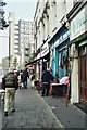
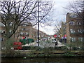

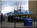

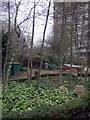
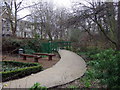
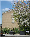
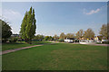
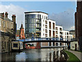
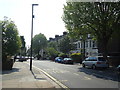
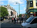
100 photos from this area
Area Information
Key information about the W10 4JE including its size, population, and administrative classification.
- Area Type
- Postcode
- Area Size
- 5534 m²
- Population
- 1824
- Population Density
- 18843 people/km²
House Prices in W10 4JE
49
Properties
£512,463
Average Sold Price
£92,000
Lowest Price
£1,635,000
Highest Price
Showing 49 properties
| Address | Type | Beds | Baths | Last Sale Price | Last Sale Date | |
|---|---|---|---|---|---|---|
| 4 Marne Street, London, W10 4JE | Terraced | 4 | 2 | £1,635,000 | May 2025 | |
| 19 Marne Street, London, W10 4JE | Terraced | 2 | 1 | £675,000 | Jun 2024 | |
| 26 Marne Street, London, W10 4JE | Terraced | 2 | 1 | £750,000 | Oct 2022 | |
| 15 Marne Street, London, W10 4JE | house | 2 | 1 | £999,950 | Sep 2022 | |
| 10 Marne Street, London, W10 4JE | Terraced | 2 | 1 | £740,000 | Jun 2022 | |
| 5 Marne Street, London, W10 4JE | Terraced | 2 | 1 | £800,000 | Apr 2019 | |
| 22 Marne Street, London, W10 4JE | Terraced | 2 | 1 | £700,000 | Oct 2018 | |
| 20 Marne Street, London, W10 4JE | Terraced | 2 | 1 | £720,000 | Jul 2018 | |
| 1 Marne Street, London, W10 4JE | Terraced | 2 | 1 | £710,000 | Mar 2014 | |
| 12 Marne Street, London, W10 4JE | Cottage | 2 | 1 | £403,800 | Feb 2012 |
Page 1 of 5
Energy Efficiency in W10 4JE
Amenities
Schools
| Rank | School | Type | Entry gender | Ages |
|---|
Explore more schools in this area
Go to Schools tabDemographics
Household Size
Two person
most common
Accommodation Type
Houses
most common
Tenure
28
majority
Ethnic Group
White
most common
Religion
N/A
most common
Household Composition
N/A
most common
Age
47
median
Adults (30-64 years)
most common
Household Deprivation
N/A
with no deprivation
NS-SEC
32
in Lower managerial occupations
Explore more demographic insights in this area
Go to Demographics tabPlanning
Planning Constraints
- Flood RiskPremium
- Ramsar Wetland SitesPremium
- Area of Outstanding Natural BeautyPremium
- Protected Nature ReservePremium
- Protected WoodlandPremium