Area Overview for W10 4AB
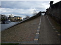
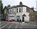
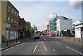
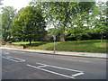
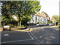
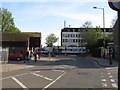
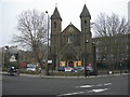
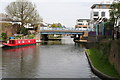
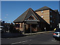
Photos of W10 4AB


Area Information
W10 4AB is a tightly defined residential cluster covering just 2,898 square metres. It serves a population of 2,274 occupants within this small footprint. Living in W10 4AB means navigating a compact environment where every resident is within close proximity to key transport nodes and local services. The location functions primarily as a dense residential hub, catering to those who value immediate access to major transport arteries over expansive grounds. You are situated in an area characterised by its efficiency and proximity to London's wider infrastructure. The limited landmass dictates a high-density living arrangement, typical of inner-west London postcode sectors. Daily life here revolves around the convenience of being a short walk or tube ride away from significant commercial and leisure districts. While the area size is small, its strategic position offers residents direct links to wider city functions without requiring extensive travel times. Owners and renters alike benefit from the centralised nature of the cluster, which minimises the distance to work, schools, and amenities. ### The community in W10 4AB is anchored by adults aged between 30 and 64 years. This age range represents the most common demographic in the postcode. The median age across the area stands at 47 years, confirming a mature population profile. Currently, 30 per cent of households in W10 4AB are owner-occupied, while the remaining 70 per cent reside in rental accommodation. This indicates a market where rent is as dominant as ownership. The predominant ethnic group identified in the area is White, reflecting the traditional demographic makeup of Inner West London. The area primarily consists of houses, distinguishing it from nearby cluster-only zones. With a population density calculated at 784,710 people per square kilometre, you can expect a lively but confined atmosphere. Living in W10 4AB involves sharing space with a significant number of neighbours in a relatively small geographical area, creating a neighbourhood feel that is intense and closely knit. ### The housing stock in W10 4AB is defined by a predominance of houses, rather than flats or purpose-built blocks. This accommodation type suggests a该区 likely contains older residential structures typical of the local lattice. You will find that only 30 per cent of residents own their homes outright. The remaining 70 per cent of the market is leased, indicating a strong rental sector operating alongside private owners. This mix means you can access a variety of tenures when searching for homes in W10 4AB. The small physical size of the area limits the total volume of properties available in this specific code. Buyers looking at this postcode should be prepared for a competitive environment where ownership and renting exist in significant balance. The presence of houses implies a desire for more private space than commonly found in high-rise developments. Understanding this split between owner-occupied and rented stock is crucial for any purchase consideration. ### Families considering W10 4AB have access to specific educational institutions in their immediate vicinity. The nearest option listed is Bales College. This institution is classified as an independent school. The Ofsted rating for Bales College is currently inadequate. Knowing this fact is vital for parents making schooling decisions for children living in W10 4AB. There is no other school data provided for this specific postcode sector in the available records. The presence of an independent school with an inadequate rating presents a specific challenge for families who prioritise current educational performance metrics. While independent schools often provide alternative pathways to state education, the current rating requires external research to understand the full context of the school's curriculum and facilities. Prospective homebuyers must weigh the location against the specific educational performance of Bales College. ### Localisation in W10 4AB prioritises seamless digital connectivity for remote work and daily communication. Fixed broadband quality scores 89 out of 100, which represents an excellent service level for home internet users. Mobile network coverage also performs strongly, scoring 85 out of 100 on the same scale. These figures indicate that residents can rely on high-speed fixed lines and robust mobile data without significant interruptions. Such connectivity supports a modern lifestyle where work tasks, streaming, and communication happen instantly. The area's hardware infrastructure is robust enough to handle the demands of households working from home or managing heavy digital usage. You do not need to worry about slow internet speeds affecting your daily routine or professional obligations. The digital environment in W10 4AB is fully equipped to support high-performance requirements without lag or disconnection. ### Residents of W10 4AB enjoy excellent access to a wide array of transport and retail options. Within practical reach, you will find five distinct retail locations including Sainsburys Ladbroke and Tesco Kensal Rise. These supermarkets are central to daily grocery shopping. Transport links are comprehensive, offering five rail stations such as Kensal Green and Kensal Rise Station, plus five metro stations including Ladbroke Grove and Westbourne Park Station. Furthermore, five ferry stops like Little Venice Waterbus provide unique water-based travel options. Three coach stations, including London Victoria Coach Station, serve as major departure points for regional travel. This density of amenities means you never have to travel far for essentials or commute. Living in W10 4AB provides a lifestyle where work, shop, and leisure destinations are integrated into a short daily journey. ### Environmental and safety assessments reveal a mixed picture for residents in W10 4AB. The area passes for flood risk, Ramsar wetland sites, Area of Outstanding Natural Beauty, protected nature reserves, and protected woodland. All these planning constraint scores are zero, indicating no coverage or inherent risk in these specific environmental categories. However, the crime risk assessment presents a different reality. This category receives a warning level with a score of 66 out of 100. A score of 66 places the risk in a medium category, meaning crime rates are around the national average. Standard security precautions remain advisable for homeowners and tenants. While the environmental hazards are absent, the crime risk is not negligible and requires standard vigilance. You should approach the area with a balanced view, acknowledging the environmental safety while respecting the need for standard urban security measures. ### Who primarily lives in W10 4AB?The population in W10 4AB is predominantly adults aged between 30 and 64 years, with a median age of 47. Only 30 per cent of households are owner-occupied, meaning the majority of residents are renters. The area consists primarily of houses and has a population of 2,274 people within 2,898 square metres. How are the schools near W10 4AB?The nearest listed school is Bales College, which is an independent institution. It currently holds an Ofsted rating of inadequate. Families relying on this school for education should investigate further as this rating indicates specific areas for improvement in the school's performance. What transport links connect W10 4AB?The area is well-connected with five rail stations including Kensal Green, five metro stations like Ladbroke Grove, and five ferry stops such as Little Venice Waterbus. Additionally, three coach stations including London Victoria Coach Station are within practical reach for regional travel. Is W10 4AB a safe place to live?Environmental risks are low as the area passes for flood risk and protected sites with zero scores. However, crime risk is rated as medium with a score of 66 out of 100. This indicates crime rates are around average, suggesting standard security precautions are necessary for residents. What amenities are available nearby?Residents have access to five retail outlets including Sainsburys Ladbroke and Tesco Kensal Rise. Transport infrastructure includes rail, metro, ferry, and bus stations, ensuring convenient access to shops, work, and leisure venues throughout West London.
- Area Type
- Postcode
- Area Size
- 2898 m²
- Population
- 2274
- Population Density
- 19255 people/km²
The housing stock in W10 4AB is defined by a predominance of houses, rather than flats or purpose-built blocks. This accommodation type suggests a该区 likely contains older residential structures typical of the local lattice. You will find that only 30 per cent of residents own their homes outright. The remaining 70 per cent of the market is leased, indicating a strong rental sector operating alongside private owners. This mix means you can access a variety of tenures when searching for homes in W10 4AB. The small physical size of the area limits the total volume of properties available in this specific code. Buyers looking at this postcode should be prepared for a competitive environment where ownership and renting exist in significant balance. The presence of houses implies a desire for more private space than commonly found in high-rise developments. Understanding this split between owner-occupied and rented stock is crucial for any purchase consideration. ### Families considering W10 4AB have access to specific educational institutions in their immediate vicinity. The nearest option listed is Bales College. This institution is classified as an independent school. The Ofsted rating for Bales College is currently inadequate. Knowing this fact is vital for parents making schooling decisions for children living in W10 4AB. There is no other school data provided for this specific postcode sector in the available records. The presence of an independent school with an inadequate rating presents a specific challenge for families who prioritise current educational performance metrics. While independent schools often provide alternative pathways to state education, the current rating requires external research to understand the full context of the school's curriculum and facilities. Prospective homebuyers must weigh the location against the specific educational performance of Bales College. ### Localisation in W10 4AB prioritises seamless digital connectivity for remote work and daily communication. Fixed broadband quality scores 89 out of 100, which represents an excellent service level for home internet users. Mobile network coverage also performs strongly, scoring 85 out of 100 on the same scale. These figures indicate that residents can rely on high-speed fixed lines and robust mobile data without significant interruptions. Such connectivity supports a modern lifestyle where work tasks, streaming, and communication happen instantly. The area's hardware infrastructure is robust enough to handle the demands of households working from home or managing heavy digital usage. You do not need to worry about slow internet speeds affecting your daily routine or professional obligations. The digital environment in W10 4AB is fully equipped to support high-performance requirements without lag or disconnection. ### Residents of W10 4AB enjoy excellent access to a wide array of transport and retail options. Within practical reach, you will find five distinct retail locations including Sainsburys Ladbroke and Tesco Kensal Rise. These supermarkets are central to daily grocery shopping. Transport links are comprehensive, offering five rail stations such as Kensal Green and Kensal Rise Station, plus five metro stations including Ladbroke Grove and Westbourne Park Station. Furthermore, five ferry stops like Little Venice Waterbus provide unique water-based travel options. Three coach stations, including London Victoria Coach Station, serve as major departure points for regional travel. This density of amenities means you never have to travel far for essentials or commute. Living in W10 4AB provides a lifestyle where work, shop, and leisure destinations are integrated into a short daily journey. ### Environmental and safety assessments reveal a mixed picture for residents in W10 4AB. The area passes for flood risk, Ramsar wetland sites, Area of Outstanding Natural Beauty, protected nature reserves, and protected woodland. All these planning constraint scores are zero, indicating no coverage or inherent risk in these specific environmental categories. However, the crime risk assessment presents a different reality. This category receives a warning level with a score of 66 out of 100. A score of 66 places the risk in a medium category, meaning crime rates are around the national average. Standard security precautions remain advisable for homeowners and tenants. While the environmental hazards are absent, the crime risk is not negligible and requires standard vigilance. You should approach the area with a balanced view, acknowledging the environmental safety while respecting the need for standard urban security measures. ### Who primarily lives in W10 4AB?The population in W10 4AB is predominantly adults aged between 30 and 64 years, with a median age of 47. Only 30 per cent of households are owner-occupied, meaning the majority of residents are renters. The area consists primarily of houses and has a population of 2,274 people within 2,898 square metres. How are the schools near W10 4AB?The nearest listed school is Bales College, which is an independent institution. It currently holds an Ofsted rating of inadequate. Families relying on this school for education should investigate further as this rating indicates specific areas for improvement in the school's performance. What transport links connect W10 4AB?The area is well-connected with five rail stations including Kensal Green, five metro stations like Ladbroke Grove, and five ferry stops such as Little Venice Waterbus. Additionally, three coach stations including London Victoria Coach Station are within practical reach for regional travel. Is W10 4AB a safe place to live?Environmental risks are low as the area passes for flood risk and protected sites with zero scores. However, crime risk is rated as medium with a score of 66 out of 100. This indicates crime rates are around average, suggesting standard security precautions are necessary for residents. What amenities are available nearby?Residents have access to five retail outlets including Sainsburys Ladbroke and Tesco Kensal Rise. Transport infrastructure includes rail, metro, ferry, and bus stations, ensuring convenient access to shops, work, and leisure venues throughout West London.
House Prices in W10 4AB
Showing 8 properties
| Address | Type | Beds | Baths | Last Sale Price | Last Sale Date | |
|---|---|---|---|---|---|---|
| 2D Kilburn Lane, London, W10 4AB | Terraced | 4 | 1 | £346,000 | Mar 2006 | |
| 2G Kilburn Lane, London, W10 4AB | house | - | - | £240,000 | Jan 2003 | |
| 2F Kilburn Lane, London, W10 4AB | Terraced | - | - | £92,500 | Oct 1995 | |
| 2B Kilburn Lane, London, W10 4AB | Terraced | - | - | - | - | |
| 2A Kilburn Lane, London, W10 4AB | Terraced | 4 | 1 | - | - | |
| 2E Kilburn Lane, London, W10 4AB | Terraced | - | - | - | - | |
| 2C Kilburn Lane, London, W10 4AB | Terraced | - | - | - | - | |
| 2H Kilburn Lane, London, W10 4AB | Terraced | - | - | - | - |
Energy Efficiency in W10 4AB
Residents of W10 4AB enjoy excellent access to a wide array of transport and retail options. Within practical reach, you will find five distinct retail locations including Sainsburys Ladbroke and Tesco Kensal Rise. These supermarkets are central to daily grocery shopping. Transport links are comprehensive, offering five rail stations such as Kensal Green and Kensal Rise Station, plus five metro stations including Ladbroke Grove and Westbourne Park Station. Furthermore, five ferry stops like Little Venice Waterbus provide unique water-based travel options. Three coach stations, including London Victoria Coach Station, serve as major departure points for regional travel. This density of amenities means you never have to travel far for essentials or commute. Living in W10 4AB provides a lifestyle where work, shop, and leisure destinations are integrated into a short daily journey. ### Environmental and safety assessments reveal a mixed picture for residents in W10 4AB. The area passes for flood risk, Ramsar wetland sites, Area of Outstanding Natural Beauty, protected nature reserves, and protected woodland. All these planning constraint scores are zero, indicating no coverage or inherent risk in these specific environmental categories. However, the crime risk assessment presents a different reality. This category receives a warning level with a score of 66 out of 100. A score of 66 places the risk in a medium category, meaning crime rates are around the national average. Standard security precautions remain advisable for homeowners and tenants. While the environmental hazards are absent, the crime risk is not negligible and requires standard vigilance. You should approach the area with a balanced view, acknowledging the environmental safety while respecting the need for standard urban security measures. ### Who primarily lives in W10 4AB?The population in W10 4AB is predominantly adults aged between 30 and 64 years, with a median age of 47. Only 30 per cent of households are owner-occupied, meaning the majority of residents are renters. The area consists primarily of houses and has a population of 2,274 people within 2,898 square metres. How are the schools near W10 4AB?The nearest listed school is Bales College, which is an independent institution. It currently holds an Ofsted rating of inadequate. Families relying on this school for education should investigate further as this rating indicates specific areas for improvement in the school's performance. What transport links connect W10 4AB?The area is well-connected with five rail stations including Kensal Green, five metro stations like Ladbroke Grove, and five ferry stops such as Little Venice Waterbus. Additionally, three coach stations including London Victoria Coach Station are within practical reach for regional travel. Is W10 4AB a safe place to live?Environmental risks are low as the area passes for flood risk and protected sites with zero scores. However, crime risk is rated as medium with a score of 66 out of 100. This indicates crime rates are around average, suggesting standard security precautions are necessary for residents. What amenities are available nearby?Residents have access to five retail outlets including Sainsburys Ladbroke and Tesco Kensal Rise. Transport infrastructure includes rail, metro, ferry, and bus stations, ensuring convenient access to shops, work, and leisure venues throughout West London.
Amenities
Schools
Families considering W10 4AB have access to specific educational institutions in their immediate vicinity. The nearest option listed is Bales College. This institution is classified as an independent school. The Ofsted rating for Bales College is currently inadequate. Knowing this fact is vital for parents making schooling decisions for children living in W10 4AB. There is no other school data provided for this specific postcode sector in the available records. The presence of an independent school with an inadequate rating presents a specific challenge for families who prioritise current educational performance metrics. While independent schools often provide alternative pathways to state education, the current rating requires external research to understand the full context of the school's curriculum and facilities. Prospective homebuyers must weigh the location against the specific educational performance of Bales College. ### Localisation in W10 4AB prioritises seamless digital connectivity for remote work and daily communication. Fixed broadband quality scores 89 out of 100, which represents an excellent service level for home internet users. Mobile network coverage also performs strongly, scoring 85 out of 100 on the same scale. These figures indicate that residents can rely on high-speed fixed lines and robust mobile data without significant interruptions. Such connectivity supports a modern lifestyle where work tasks, streaming, and communication happen instantly. The area's hardware infrastructure is robust enough to handle the demands of households working from home or managing heavy digital usage. You do not need to worry about slow internet speeds affecting your daily routine or professional obligations. The digital environment in W10 4AB is fully equipped to support high-performance requirements without lag or disconnection. ### Residents of W10 4AB enjoy excellent access to a wide array of transport and retail options. Within practical reach, you will find five distinct retail locations including Sainsburys Ladbroke and Tesco Kensal Rise. These supermarkets are central to daily grocery shopping. Transport links are comprehensive, offering five rail stations such as Kensal Green and Kensal Rise Station, plus five metro stations including Ladbroke Grove and Westbourne Park Station. Furthermore, five ferry stops like Little Venice Waterbus provide unique water-based travel options. Three coach stations, including London Victoria Coach Station, serve as major departure points for regional travel. This density of amenities means you never have to travel far for essentials or commute. Living in W10 4AB provides a lifestyle where work, shop, and leisure destinations are integrated into a short daily journey. ### Environmental and safety assessments reveal a mixed picture for residents in W10 4AB. The area passes for flood risk, Ramsar wetland sites, Area of Outstanding Natural Beauty, protected nature reserves, and protected woodland. All these planning constraint scores are zero, indicating no coverage or inherent risk in these specific environmental categories. However, the crime risk assessment presents a different reality. This category receives a warning level with a score of 66 out of 100. A score of 66 places the risk in a medium category, meaning crime rates are around the national average. Standard security precautions remain advisable for homeowners and tenants. While the environmental hazards are absent, the crime risk is not negligible and requires standard vigilance. You should approach the area with a balanced view, acknowledging the environmental safety while respecting the need for standard urban security measures. ### Who primarily lives in W10 4AB?The population in W10 4AB is predominantly adults aged between 30 and 64 years, with a median age of 47. Only 30 per cent of households are owner-occupied, meaning the majority of residents are renters. The area consists primarily of houses and has a population of 2,274 people within 2,898 square metres. How are the schools near W10 4AB?The nearest listed school is Bales College, which is an independent institution. It currently holds an Ofsted rating of inadequate. Families relying on this school for education should investigate further as this rating indicates specific areas for improvement in the school's performance. What transport links connect W10 4AB?The area is well-connected with five rail stations including Kensal Green, five metro stations like Ladbroke Grove, and five ferry stops such as Little Venice Waterbus. Additionally, three coach stations including London Victoria Coach Station are within practical reach for regional travel. Is W10 4AB a safe place to live?Environmental risks are low as the area passes for flood risk and protected sites with zero scores. However, crime risk is rated as medium with a score of 66 out of 100. This indicates crime rates are around average, suggesting standard security precautions are necessary for residents. What amenities are available nearby?Residents have access to five retail outlets including Sainsburys Ladbroke and Tesco Kensal Rise. Transport infrastructure includes rail, metro, ferry, and bus stations, ensuring convenient access to shops, work, and leisure venues throughout West London.
| Rank | School | Type | Entry gender | Ages |
|---|
Explore more schools in this area
Go to Schools tabDemographics
The community in W10 4AB is anchored by adults aged between 30 and 64 years. This age range represents the most common demographic in the postcode. The median age across the area stands at 47 years, confirming a mature population profile. Currently, 30 per cent of households in W10 4AB are owner-occupied, while the remaining 70 per cent reside in rental accommodation. This indicates a market where rent is as dominant as ownership. The predominant ethnic group identified in the area is White, reflecting the traditional demographic makeup of Inner West London. The area primarily consists of houses, distinguishing it from nearby cluster-only zones. With a population density calculated at 784,710 people per square kilometre, you can expect a lively but confined atmosphere. Living in W10 4AB involves sharing space with a significant number of neighbours in a relatively small geographical area, creating a neighbourhood feel that is intense and closely knit. ### The housing stock in W10 4AB is defined by a predominance of houses, rather than flats or purpose-built blocks. This accommodation type suggests a该区 likely contains older residential structures typical of the local lattice. You will find that only 30 per cent of residents own their homes outright. The remaining 70 per cent of the market is leased, indicating a strong rental sector operating alongside private owners. This mix means you can access a variety of tenures when searching for homes in W10 4AB. The small physical size of the area limits the total volume of properties available in this specific code. Buyers looking at this postcode should be prepared for a competitive environment where ownership and renting exist in significant balance. The presence of houses implies a desire for more private space than commonly found in high-rise developments. Understanding this split between owner-occupied and rented stock is crucial for any purchase consideration. ### Families considering W10 4AB have access to specific educational institutions in their immediate vicinity. The nearest option listed is Bales College. This institution is classified as an independent school. The Ofsted rating for Bales College is currently inadequate. Knowing this fact is vital for parents making schooling decisions for children living in W10 4AB. There is no other school data provided for this specific postcode sector in the available records. The presence of an independent school with an inadequate rating presents a specific challenge for families who prioritise current educational performance metrics. While independent schools often provide alternative pathways to state education, the current rating requires external research to understand the full context of the school's curriculum and facilities. Prospective homebuyers must weigh the location against the specific educational performance of Bales College. ### Localisation in W10 4AB prioritises seamless digital connectivity for remote work and daily communication. Fixed broadband quality scores 89 out of 100, which represents an excellent service level for home internet users. Mobile network coverage also performs strongly, scoring 85 out of 100 on the same scale. These figures indicate that residents can rely on high-speed fixed lines and robust mobile data without significant interruptions. Such connectivity supports a modern lifestyle where work tasks, streaming, and communication happen instantly. The area's hardware infrastructure is robust enough to handle the demands of households working from home or managing heavy digital usage. You do not need to worry about slow internet speeds affecting your daily routine or professional obligations. The digital environment in W10 4AB is fully equipped to support high-performance requirements without lag or disconnection. ### Residents of W10 4AB enjoy excellent access to a wide array of transport and retail options. Within practical reach, you will find five distinct retail locations including Sainsburys Ladbroke and Tesco Kensal Rise. These supermarkets are central to daily grocery shopping. Transport links are comprehensive, offering five rail stations such as Kensal Green and Kensal Rise Station, plus five metro stations including Ladbroke Grove and Westbourne Park Station. Furthermore, five ferry stops like Little Venice Waterbus provide unique water-based travel options. Three coach stations, including London Victoria Coach Station, serve as major departure points for regional travel. This density of amenities means you never have to travel far for essentials or commute. Living in W10 4AB provides a lifestyle where work, shop, and leisure destinations are integrated into a short daily journey. ### Environmental and safety assessments reveal a mixed picture for residents in W10 4AB. The area passes for flood risk, Ramsar wetland sites, Area of Outstanding Natural Beauty, protected nature reserves, and protected woodland. All these planning constraint scores are zero, indicating no coverage or inherent risk in these specific environmental categories. However, the crime risk assessment presents a different reality. This category receives a warning level with a score of 66 out of 100. A score of 66 places the risk in a medium category, meaning crime rates are around the national average. Standard security precautions remain advisable for homeowners and tenants. While the environmental hazards are absent, the crime risk is not negligible and requires standard vigilance. You should approach the area with a balanced view, acknowledging the environmental safety while respecting the need for standard urban security measures. ### Who primarily lives in W10 4AB?The population in W10 4AB is predominantly adults aged between 30 and 64 years, with a median age of 47. Only 30 per cent of households are owner-occupied, meaning the majority of residents are renters. The area consists primarily of houses and has a population of 2,274 people within 2,898 square metres. How are the schools near W10 4AB?The nearest listed school is Bales College, which is an independent institution. It currently holds an Ofsted rating of inadequate. Families relying on this school for education should investigate further as this rating indicates specific areas for improvement in the school's performance. What transport links connect W10 4AB?The area is well-connected with five rail stations including Kensal Green, five metro stations like Ladbroke Grove, and five ferry stops such as Little Venice Waterbus. Additionally, three coach stations including London Victoria Coach Station are within practical reach for regional travel. Is W10 4AB a safe place to live?Environmental risks are low as the area passes for flood risk and protected sites with zero scores. However, crime risk is rated as medium with a score of 66 out of 100. This indicates crime rates are around average, suggesting standard security precautions are necessary for residents. What amenities are available nearby?Residents have access to five retail outlets including Sainsburys Ladbroke and Tesco Kensal Rise. Transport infrastructure includes rail, metro, ferry, and bus stations, ensuring convenient access to shops, work, and leisure venues throughout West London.
Household Size
Accommodation Type
Tenure
Ethnic Group
Religion
Household Composition
Age
Household Deprivation
NS-SEC
Explore more demographic insights in this area
Go to Demographics tabPlanning
Planning Constraints
- Flood RiskPremium
- Ramsar Wetland SitesPremium
- Area of Outstanding Natural BeautyPremium
- Protected Nature ReservePremium
- Protected WoodlandPremium