Area Overview for Upper Walthamstow Ward
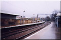
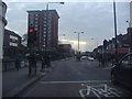
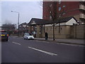
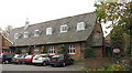
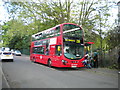
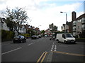
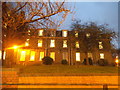
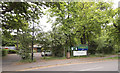
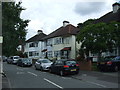
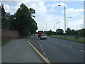
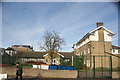
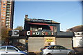
Photos of Upper Walthamstow Ward
Area Information
Upper Walthamstow Ward is a compact district within the London Borough of Waltham Forest, covering an area of just 1.7 square kilometres. Despite its small footprint, the ward offers a distinct residential character defined by stable communities and established local infrastructure. The location serves primarily as a homebase for residents rather than a commercial hub, creating an environment where daily life revolves around the immediate neighbourhood. You will find a mature setting where the pace of living moves at a steady, consistent rhythm. The ward functions as a tightly knit community unit where established routines and familiar surroundings take precedence over rapid development or high-density urban density. Living in Upper Walthamstow Ward provides a grounded experience for those seeking a straightforward residential address in East London. The area avoids the extremes of the city centre while maintaining direct links to wider transport networks. Your daily commute and local activities depend on the specific streets and facilities found within this limited boundary. The scale of the ward means that distances to amenities are short, allowing for efficient navigation without lengthy travel times between key locations. This proximity supports a lifestyle where you can reach essential services and social spots with minimal effort. The ward represents a practical choice for buyers prioritising established residential quietude and manageable neighbourhood scales.
- Area Type
- District Borough Unitary Ward
- Area Size
- 1.7 km²
- Population
- Not available
- Population Density
- Not available
Demographics
The community within Upper Walthamstow Ward reflects a distinctly older population profile. The median age stands at 70 years, indicating that the majority of residents are senior citizens. This demographic makeup shapes the local culture, suggesting a neighbourhood where long-term stability and tradition are central values. Most households likely consist of individuals or couples residing in their own homes rather than larger families with young children. Such a demographic structure influences local demand for services and social activities suitable for mature residents. Home ownership plays a significant role in the ward's social fabric, with 53% of residents owning their property outright or with a mortgage. This ownership rate points to a market characterised by those who have remained in the area for extended periods. The predominance of owner-occupied stock reinforces the sense of permanence that defines life in Upper Walthamstow Ward. Unlike areas driven by transient rental populations, this ward hosts people with deep roots in their local community. The accommodation types and household composition further illustrate a settled environment where residents have invested in their surroundings. You will find a population that values established neighbourhood links over the temporary nature of the rental sector.
Household Size
Accommodation Type
Tenure
Ethnic Group
Religion
Household Composition
Age
Household Deprivation
NS-SEC
Explore more demographic insights in this area
Go to Demographics tabPlanning
Planning Constraints
- Flood RiskPremium
- Ramsar Wetland SitesPremium
- Area of Outstanding Natural BeautyPremium
- Protected Nature ReservePremium
- Protected WoodlandPremium