Area Overview for Upper Edmonton Ward
Photos of Upper Edmonton Ward
Area Information
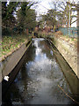
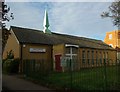
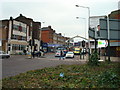
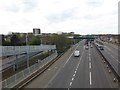
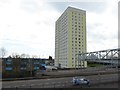
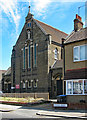
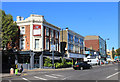
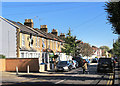
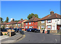
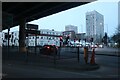
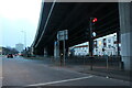
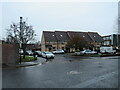
Living in Upper Edmonton Ward offers a distinct experience within the London Borough of Enfield. This 2.3 km² district forms the southern part of Edmonton, historically rooted in the ancient parish of Middlesex. The area transformed from rural marshland into a densely built urban residential zone following railway expansion in 1872. You will find yourself in a neighbourhood defined by its history, including the site of the former Edmonton Town Hall and the original workhouse location near North Middlesex University Hospital. Daily life revolves around the historic walled garden at Pymmes Park and the busy Fore Street shopping area. The community has evolved from a working-class influx in the early 20th century into a modern London borough unitary ward. While the area is now part of Greater London since 1965, it retains character from its days as an urban district established in 1894. Residents often navigate the impact of high-level lines and tramways that once shaped the landscape. The current reality blends Victorian heritage with contemporary city living, making Upper Edmonton Ward a unique chapter in North London.
- Area Type
- District Borough Unitary Ward
- Area Size
- 2.3 km²
- Population
- Not available
- Population Density
- Not available
Demographics
The community profile in Upper Edmonton Ward shows a distinct demographic pattern. The median age sits at 70 years, indicating a predominantly older population. This concentration of elderly residents suggests a neighbourhood where many long-standing families or retirees call this ward their home. You will encounter a demographic shift from the working-class surge of 1911 to a later demographic matured through decades. With 36% home ownership, you should expect a significant portion of this population to be renting rather than owning their property outright. The remaining 64% reside in rented accommodation, which may imply shared ownership, private tenancy, or social housing options within the ward. The area covers a relatively small footprint of 2.3 square kilometres, meaning residents live close to one another. While specific data on ethnic groups, religion, and household composition totals are not detailed in the provided statistics, the high median age suggests a settled community dynamic. This age profile influences local services and community events, creating an environment tailored to older generations seeking stability and proximity to healthcare facilities.
Household Size
Accommodation Type
Tenure
Ethnic Group
Religion
Household Composition
Age
Household Deprivation
NS-SEC
Explore more demographic insights in this area
Go to Demographics tabPlanning
Planning Constraints
- Flood RiskLocked
- Ramsar Wetland SitesLocked
- Area of Outstanding Natural BeautyLocked
- Protected Nature ReserveLocked
- Protected WoodlandLocked
- Crime RiskLocked