Area Overview for Underhill Ward
Photos of Underhill Ward
Area Information
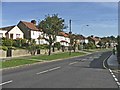
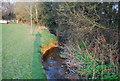
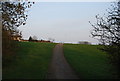
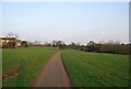
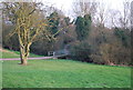
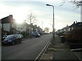
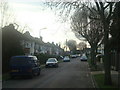
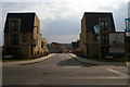
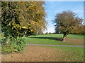
Underhill Ward is an electoral ward within the London Borough of Barnet, situated in north London near Barnet Lane. This district covers an area of 2.5 square kilometres and is home to a population of 1,513 residents. The ward first appeared in elections in 2002, electing two councillors to the Barnet London Borough Council. You will find the ward located with approximate coordinates of 51.645329, -0.208226, placing it close to the historic Underhill Stadium site. This former home of Barnet Football Club existed from 1907 until April 2013, representing a significant piece of local heritage. The site now features redevelopment plans, including proposals for educational facilities following the demolition of the original structure. Living in Underhill Ward means residing in a neighbourhood with strong historical roots and a focus on potential future development. The area is characterised by its location in the Green Belt, which influences planning constraints in the region. While the ward is small in terms of physical size, it holds meaningful cultural significance through its association with the local football club. The presence of planning permissions from 1990 to 2008 alongside a 2017 refused application for a school highlights the ongoing evolution of the land use. prospective homebuyers should consider the unique position of this ward where sporting history meets modern educational proposals, all within a compact and well-defined borough unitary boundary.
- Area Type
- District Borough Unitary Ward
- Area Size
- 2.5 km²
- Population
- 1513
- Population Density
- 595 people/km²
Demographics
The community in Underhill Ward displays distinct demographic characteristics that define daily life for its 1,513 residents. The median age for the population is 70 years, indicating a predominantly older demographic compared to the London average. Most households with a total age profile reflect this elderly population structure, shaping the local services and social environment. Approximately 58% of residents own their homes, suggesting that ownership remains a significant portion of how people live in this ward within the London Borough of Barnet. When considering home ownership levels, you will find that just over half of the population has achieved proprietorship of their dwellings. The remaining households comprise tenants or other tenure types, though specific breakdowns by annual income bands are not detailed in the available records. The ward's household composition is broad, encompassing various family structures and living arrangements typical of a mature neighbourhood. As the majority of residents are aged 70 and above, the local vibe is likely quiet and established, rather than driven by young families or transient professionals. This age skew influences the type of amenities and community activities available. The high proportion of older homeowners may correlate with specific preferences for housing stock, such as bungalows or ground-floor flats, although the exact accommodation types per age bracket are not itemised. You should anticipate a community where stability and long-term residency are common features. The demographic profile suggests a neighbourhood where residents have settled permanently, contributing to a population that has remained relatively static over recent years. Understanding this age distribution helps you gauge whether the environment suits your lifestyle needs, particularly if you consider the impact of an older demographic on local social cohesion and service demand.
Household Size
Accommodation Type
Tenure
Ethnic Group
Religion
Household Composition
Age
Household Deprivation
NS-SEC
Explore more demographic insights in this area
Go to Demographics tabPlanning
Planning Constraints
- Flood RiskPremium
- Ramsar Wetland SitesPremium
- Area of Outstanding Natural BeautyPremium
- Protected Nature ReservePremium
- Protected WoodlandPremium
- Crime RiskPremium