Area Overview for UB9 6PD
Photos of UB9 6PD
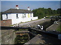
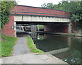
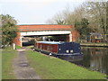
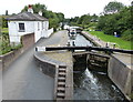
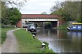
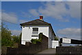
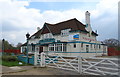
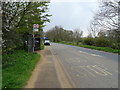
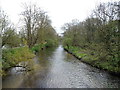
67 photos from this area
Area Information
Key information about the UB9 6PD including its size, population, and administrative classification.
- Area Type
- Postcode
- Area Size
- 11.4 hectares
- Population
- 1625
- Population Density
- 822 people/km²
House Prices in UB9 6PD
8
Properties
£840,000
Average Sold Price
£840,000
Lowest Price
£840,000
Highest Price
Showing 8 properties
| Address | Type | Beds | Baths | Last Sale Price | Last Sale Date | |
|---|---|---|---|---|---|---|
| Moor House, Moorhall Road, Harefield, UB9 6PD | house | 4 | 2 | £840,000 | Dec 2020 | |
| Caravan 3, Broadwater Pit, Moorhall Road, Harefield, UB9 6PD | Detached | 2 | 1 | - | - | |
| Moorside, Moorhall Road, Harefield, UB9 6PD | house | - | - | - | - | |
| Fair Rosamund, Moorhall Road, Harefield, UB9 6PD | Houseboat | - | - | - | - | |
| Lock Cottage, Moorhall Road, Harefield, UB9 6PD | Detached | - | - | - | - | |
| Dellside Cottage, Moorhall Road, Harefield, UB9 6PD | house | - | - | - | - | |
| M J Musk Marine Sales Ltd, Harefield Boat Yard, Harefield Marina, Moorhall Road, Harefield, UB9 6PD | Industrial | - | - | - | - | |
| Hs2 Align Site Office, Moorhall Road, Harefield, UB9 6PD | Office | - | - | - | - |
Energy Efficiency in UB9 6PD
Amenities
Schools
| Rank | School | Type | Entry gender | Ages |
|---|
Explore more schools in this area
Go to Schools tabDemographics
Household Size
Family (3-5 people)
most common
Accommodation Type
Houses
most common
Tenure
64
majority
Ethnic Group
White
most common
Religion
N/A
most common
Household Composition
N/A
most common
Age
47
median
Adults (30-64 years)
most common
Household Deprivation
N/A
with no deprivation
NS-SEC
30
in Lower managerial occupations
Explore more demographic insights in this area
Go to Demographics tabPlanning
Planning Constraints
- Flood RiskPremium
- Ramsar Wetland SitesPremium
- Area of Outstanding Natural BeautyPremium
- Protected Nature ReservePremium
- Protected WoodlandPremium