Area Overview for UB9 6EL
Photos of UB9 6EL
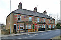
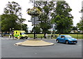
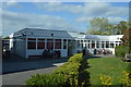
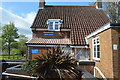
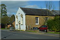
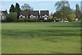
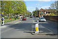
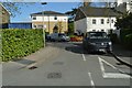
98 photos from this area
Area Information
Key information about the UB9 6EL including its size, population, and administrative classification.
- Area Type
- Postcode
- Area Size
- 9901 m²
- Population
- 1549
- Population Density
- 2203 people/km²
House Prices in UB9 6EL
29
Properties
£322,825
Average Sold Price
£160,000
Lowest Price
£540,882
Highest Price
Showing 29 properties
| Address | Type | Beds | Baths | Last Sale Price | Last Sale Date | |
|---|---|---|---|---|---|---|
| 55 Newdigate Road, Harefield, UB9 6EL | Terraced | 3 | 1 | £411,000 | Jan 2021 | |
| 57 Newdigate Road, Harefield, UB9 6EL | house | 2 | - | £540,882 | Aug 2020 | |
| 61 Newdigate Road, Harefield, UB9 6EL | Terraced | 3 | - | £402,000 | Jul 2020 | |
| 79A Newdigate Road, Harefield, UB9 6EL | Detached | 4 | - | £475,000 | Feb 2018 | |
| 53 Newdigate Road, Harefield, UB9 6EL | house | 3 | 1 | £415,000 | Nov 2017 | |
| 59 Newdigate Road, Harefield, UB9 6EL | house | 3 | - | £400,000 | Nov 2016 | |
| 63 Newdigate Road, Harefield, UB9 6EL | house | - | - | £407,500 | Dec 2015 | |
| 22 Newdigate Road, Harefield, UB9 6EL | house | - | - | £310,000 | Apr 2014 | |
| 65 Newdigate Road, Harefield, UB9 6EL | Semi-detached | - | - | £243,000 | Sep 2007 | |
| 75 Newdigate Road, Harefield, UB9 6EL | Semi-detached | - | - | £245,000 | May 2006 |
Page 1 of 3
Energy Efficiency in UB9 6EL
Amenities
Schools
| Rank | School | Type | Entry gender | Ages |
|---|
Explore more schools in this area
Go to Schools tabDemographics
Household Size
Family (3-5 people)
most common
Accommodation Type
Houses
most common
Tenure
62
majority
Ethnic Group
White
most common
Religion
N/A
most common
Household Composition
N/A
most common
Age
47
median
Adults (30-64 years)
most common
Household Deprivation
N/A
with no deprivation
NS-SEC
35
in Lower managerial occupations
Explore more demographic insights in this area
Go to Demographics tabPlanning
Planning Constraints
- Flood RiskPremium
- Ramsar Wetland SitesPremium
- Area of Outstanding Natural BeautyPremium
- Protected Nature ReservePremium
- Protected WoodlandPremium