Area Overview for UB9 6AL
Photos of UB9 6AL

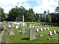
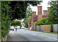
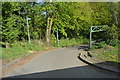
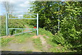
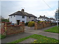
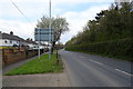
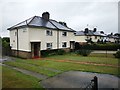
79 photos from this area
Area Information
Key information about the UB9 6AL including its size, population, and administrative classification.
- Area Type
- Postcode
- Area Size
- 2.4 hectares
- Population
- 1625
- Population Density
- 822 people/km²
House Prices in UB9 6AL
50
Properties
£303,919
Average Sold Price
£74,950
Lowest Price
£605,000
Highest Price
Showing 50 properties
| Address | Type | Beds | Baths | Last Sale Price | Last Sale Date | |
|---|---|---|---|---|---|---|
| 18 Broadwater Gardens, Harefield, UB9 6AL | Semi-detached | 2 | 1 | £375,000 | Jun 2025 | |
| 24 Broadwater Gardens, Harefield, UB9 6AL | Terraced | 2 | 1 | £445,000 | Mar 2025 | |
| 36A Broadwater Gardens, Harefield, UB9 6AL | Detached | 2 | 1 | £600,000 | Mar 2025 | |
| 3 Broadwater Gardens, Harefield, UB9 6AL | Semi-detached | 4 | 3 | £550,000 | Feb 2025 | |
| 35 Broadwater Gardens, Harefield, UB9 6AL | Maisonette | 2 | 1 | £315,000 | Jul 2024 | |
| 4 Broadwater Gardens, Harefield, UB9 6AL | Semi-detached | 2 | 1 | £411,000 | May 2024 | |
| 47 Broadwater Gardens, Harefield, UB9 6AL | Flat | 2 | 1 | £305,000 | Aug 2022 | |
| 27 Broadwater Gardens, Harefield, UB9 6AL | Maisonette | - | - | £290,000 | Aug 2021 | |
| 15 Broadwater Gardens, Harefield, UB9 6AL | house | - | - | £390,000 | Jun 2021 | |
| 31 Broadwater Gardens, Harefield, UB9 6AL | Maisonette | 2 | 1 | £300,000 | Jun 2021 |
Page 1 of 5
Energy Efficiency in UB9 6AL
Amenities
Schools
| Rank | School | Type | Entry gender | Ages |
|---|
Explore more schools in this area
Go to Schools tabDemographics
Household Size
Family (3-5 people)
most common
Accommodation Type
Houses
most common
Tenure
64
majority
Ethnic Group
White
most common
Religion
N/A
most common
Household Composition
N/A
most common
Age
47
median
Adults (30-64 years)
most common
Household Deprivation
N/A
with no deprivation
NS-SEC
30
in Lower managerial occupations
Explore more demographic insights in this area
Go to Demographics tabPlanning
Planning Constraints
- Flood RiskPremium
- Ramsar Wetland SitesPremium
- Area of Outstanding Natural BeautyPremium
- Protected Nature ReservePremium
- Protected WoodlandPremium