Area Overview for UB9 6AD
Photos of UB9 6AD

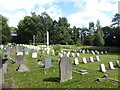
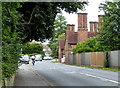
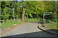
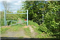
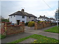
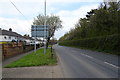
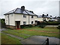
79 photos from this area
Area Information
Key information about the UB9 6AD including its size, population, and administrative classification.
- Area Type
- Postcode
- Area Size
- 1.5 hectares
- Population
- 1625
- Population Density
- 822 people/km²
House Prices in UB9 6AD
27
Properties
£368,533
Average Sold Price
£60,000
Lowest Price
£530,000
Highest Price
Showing 27 properties
| Address | Type | Beds | Baths | Last Sale Price | Last Sale Date | |
|---|---|---|---|---|---|---|
| 5 St Marys Road, Harefield, UB9 6AD | Semi-detached | 3 | 1 | £530,000 | Mar 2025 | |
| 21 St Marys Road, Harefield, UB9 6AD | Semi-detached | 3 | 1 | £460,000 | Dec 2023 | |
| 15 St Marys Road, Harefield, UB9 6AD | Retail | 3 | 1 | £501,500 | May 2022 | |
| 28 St Marys Road, Harefield, UB9 6AD | Retail | 3 | 1 | £485,000 | Mar 2022 | |
| 18 St Marys Road, Harefield, UB9 6AD | house | - | - | £445,000 | Nov 2021 | |
| 22 St Marys Road, Harefield, UB9 6AD | Semi-detached | 3 | 1 | £440,325 | Oct 2019 | |
| 6 St Marys Road, Harefield, UB9 6AD | Semi-detached | - | - | £278,500 | Dec 2013 | |
| 9 St Marys Road, Harefield, UB9 6AD | house | - | - | £210,000 | Jan 2011 | |
| 34 St Marys Road, Harefield, UB9 6AD | house | - | - | £275,000 | Jan 2010 | |
| 2 St Marys Road, Harefield, UB9 6AD | house | - | - | £60,000 | Jul 2002 |
Page 1 of 3
Energy Efficiency in UB9 6AD
Amenities
Schools
| Rank | School | Type | Entry gender | Ages |
|---|
Explore more schools in this area
Go to Schools tabDemographics
Household Size
Family (3-5 people)
most common
Accommodation Type
Houses
most common
Tenure
64
majority
Ethnic Group
White
most common
Religion
N/A
most common
Household Composition
N/A
most common
Age
47
median
Adults (30-64 years)
most common
Household Deprivation
N/A
with no deprivation
NS-SEC
30
in Lower managerial occupations
Explore more demographic insights in this area
Go to Demographics tabPlanning
Planning Constraints
- Flood RiskPremium
- Ramsar Wetland SitesPremium
- Area of Outstanding Natural BeautyPremium
- Protected Nature ReservePremium
- Protected WoodlandPremium