Area Overview for UB8 3UA
Photos of UB8 3UA
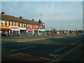
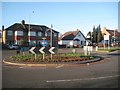
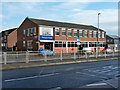
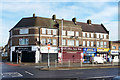
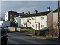
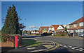
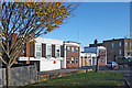
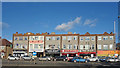
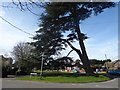
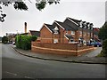
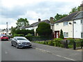
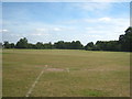
20 photos from this area
Area Information
Key information about the UB8 3UA including its size, population, and administrative classification.
- Area Type
- Postcode
- Area Size
- 4691 m²
- Population
- 1651
- Population Density
- 8206 people/km²
House Prices in UB8 3UA
29
Properties
£213,230
Average Sold Price
£64,950
Lowest Price
£365,000
Highest Price
Showing 29 properties
| Address | Type | Beds | Baths | Last Sale Price | Last Sale Date | |
|---|---|---|---|---|---|---|
| 15 Aldenham Drive, Uxbridge, UB8 3UA | Semi-detached | 1 | 1 | £269,950 | Jan 2025 | |
| 17 Aldenham Drive, Uxbridge, UB8 3UA | Semi-detached | 1 | 1 | £285,000 | Jul 2024 | |
| 3 Aldenham Drive, Uxbridge, UB8 3UA | Semi-detached | 1 | 1 | £293,000 | Feb 2024 | |
| 10 Aldenham Drive, Uxbridge, UB8 3UA | Semi-detached | 1 | 1 | £257,000 | Mar 2022 | |
| 19 Aldenham Drive, Uxbridge, UB8 3UA | Semi-detached | 2 | 1 | £365,000 | May 2021 | |
| 18 Aldenham Drive, Uxbridge, UB8 3UA | Terraced | 2 | 1 | £330,000 | Feb 2020 | |
| 23 Aldenham Drive, Uxbridge, UB8 3UA | Terraced | 2 | - | £300,000 | Aug 2017 | |
| 35 Aldenham Drive, Uxbridge, UB8 3UA | Semi-detached | 1 | 1 | £240,000 | Oct 2016 | |
| 25 Aldenham Drive, Uxbridge, UB8 3UA | Terraced | 2 | - | £347,000 | Mar 2016 | |
| 9 Aldenham Drive, Uxbridge, UB8 3UA | Terraced | 2 | - | £314,000 | Feb 2016 |
Page 1 of 3
Energy Efficiency in UB8 3UA
Amenities
Schools
| Rank | School | Type | Entry gender | Ages |
|---|
Explore more schools in this area
Go to Schools tabDemographics
Household Size
Family (3-5 people)
most common
Accommodation Type
Houses
most common
Tenure
39
majority
Ethnic Group
White
most common
Religion
N/A
most common
Household Composition
N/A
most common
Age
47
median
Adults (30-64 years)
most common
Household Deprivation
N/A
with no deprivation
NS-SEC
25
in Lower managerial occupations
Explore more demographic insights in this area
Go to Demographics tabPlanning
Planning Constraints
- Flood RiskPremium
- Ramsar Wetland SitesPremium
- Area of Outstanding Natural BeautyPremium
- Protected Nature ReservePremium
- Protected WoodlandPremium