Area Overview for UB8 3DG
Photos of UB8 3DG
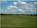
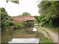
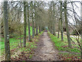
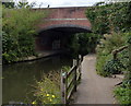

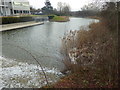
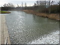
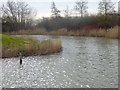
45 photos from this area
Area Information
Key information about the UB8 3DG including its size, population, and administrative classification.
- Area Type
- Postcode
- Area Size
- 27.6 hectares
- Population
- 1996
- Population Density
- 3309 people/km²
House Prices in UB8 3DG
26
Properties
£330,821
Average Sold Price
£72,000
Lowest Price
£460,000
Highest Price
Showing 26 properties
| Address | Type | Beds | Baths | Last Sale Price | Last Sale Date | |
|---|---|---|---|---|---|---|
| 32 Goulds Green, Uxbridge, UB8 3DG | Semi-detached | 3 | 1 | £460,000 | Apr 2025 | |
| 54 Goulds Green, Uxbridge, UB8 3DG | Semi-detached | 3 | 1 | £380,000 | Jul 2024 | |
| 36 Goulds Green, Uxbridge, UB8 3DG | Detached | 3 | 1 | £460,000 | Sep 2021 | |
| 18 Goulds Green, Uxbridge, UB8 3DG | house | 3 | - | £458,000 | May 2021 | |
| 22 Goulds Green, Uxbridge, UB8 3DG | Semi-detached | 3 | 1 | £425,000 | Dec 2020 | |
| 44 Goulds Green, Uxbridge, UB8 3DG | house | - | - | £392,500 | Nov 2020 | |
| 52 Goulds Green, Uxbridge, UB8 3DG | Terraced | 3 | - | £418,000 | Jul 2020 | |
| 30 Goulds Green, Uxbridge, UB8 3DG | Bungalow | 3 | 2 | £460,000 | Jun 2016 | |
| 24 Goulds Green, Uxbridge, UB8 3DG | Semi-detached | 3 | 1 | £330,000 | Mar 2015 | |
| Mill Bourne, Goulds Green, Uxbridge, UB8 3DG | house | - | - | £439,000 | Mar 2011 |
Page 1 of 3
Energy Efficiency in UB8 3DG
Amenities
Schools
| Rank | School | Type | Entry gender | Ages |
|---|
Explore more schools in this area
Go to Schools tabDemographics
Household Size
Family (3-5 people)
most common
Accommodation Type
Houses
most common
Tenure
54
majority
Ethnic Group
White
most common
Religion
N/A
most common
Household Composition
N/A
most common
Age
47
median
Adults (30-64 years)
most common
Household Deprivation
N/A
with no deprivation
NS-SEC
23
in Lower managerial occupations
Explore more demographic insights in this area
Go to Demographics tabPlanning
Planning Constraints
- Flood RiskPremium
- Ramsar Wetland SitesPremium
- Area of Outstanding Natural BeautyPremium
- Protected Nature ReservePremium
- Protected WoodlandPremium