Area Overview for UB8 2QX
Photos of UB8 2QX
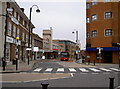
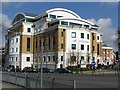
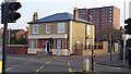
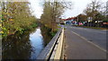
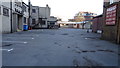
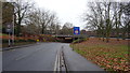
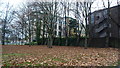
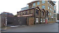
82 photos from this area
Area Information
Key information about the UB8 2QX including its size, population, and administrative classification.
- Area Type
- Postcode
- Area Size
- 2.3 hectares
- Population
- 2036
- Population Density
- 4023 people/km²
House Prices in UB8 2QX
81
Properties
£241,944
Average Sold Price
£19,540
Lowest Price
£500,000
Highest Price
Showing 81 properties
| Address | Type | Beds | Baths | Last Sale Price | Last Sale Date | |
|---|---|---|---|---|---|---|
| 26 Waterloo Road, Uxbridge, UB8 2QX | Flat | - | - | £230,000 | Jul 2024 | |
| 15 Waterloo Road, Uxbridge, UB8 2QX | Maisonette | 1 | 1 | £262,500 | Aug 2023 | |
| 16 Waterloo Road, Uxbridge, UB8 2QX | Maisonette | 1 | 1 | £250,000 | Nov 2022 | |
| 174 Waterloo Road, Uxbridge, UB8 2QX | Semi-detached | 3 | 1 | £475,000 | Feb 2022 | |
| 149 Waterloo Road, Uxbridge, UB8 2QX | Detached | 3 | 2 | £500,000 | May 2021 | |
| 160 Waterloo Road, Uxbridge, UB8 2QX | Semi-detached | 4 | 1 | £415,400 | Nov 2020 | |
| 171 Waterloo Road, Uxbridge, UB8 2QX | house | 3 | - | £400,000 | Oct 2020 | |
| 158 Waterloo Road, Uxbridge, UB8 2QX | Terraced | 3 | 1 | £415,000 | Sep 2020 | |
| 27 Waterloo Road, Uxbridge, UB8 2QX | Maisonette | 1 | 1 | £195,000 | Sep 2020 | |
| 157 Waterloo Road, Uxbridge, UB8 2QX | Terraced | 3 | 2 | £422,500 | Aug 2019 |
Page 1 of 9
Energy Efficiency in UB8 2QX
Amenities
Schools
| Rank | School | Type | Entry gender | Ages |
|---|
Explore more schools in this area
Go to Schools tabDemographics
Household Size
Family (3-5 people)
most common
Accommodation Type
Houses
most common
Tenure
43
majority
Ethnic Group
White
most common
Religion
N/A
most common
Household Composition
N/A
most common
Age
47
median
Adults (30-64 years)
most common
Household Deprivation
N/A
with no deprivation
NS-SEC
33
in Lower managerial occupations
Explore more demographic insights in this area
Go to Demographics tabPlanning
Planning Constraints
- Flood RiskPremium
- Ramsar Wetland SitesPremium
- Area of Outstanding Natural BeautyPremium
- Protected Nature ReservePremium
- Protected WoodlandPremium