Area Overview for UB8 2NZ
Photos of UB8 2NZ


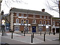
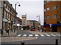

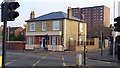
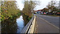

82 photos from this area
Area Information
Key information about the UB8 2NZ including its size, population, and administrative classification.
- Area Type
- Postcode
- Area Size
- 1.2 hectares
- Population
- 1424
- Population Density
- 6021 people/km²
House Prices in UB8 2NZ
83
Properties
£124,019
Average Sold Price
£26,000
Lowest Price
£205,000
Highest Price
Showing 83 properties
| Address | Type | Beds | Baths | Last Sale Price | Last Sale Date | |
|---|---|---|---|---|---|---|
| 22, Colley House, 9 Whitehall Road, Uxbridge, UB8 2NZ | Flat | - | 1 | £179,950 | Oct 2023 | |
| 26, Colley House, 9 Whitehall Road, Uxbridge, UB8 2NZ | Flat | - | 1 | £172,500 | Jan 2023 | |
| 12, Colley House, 9 Whitehall Road, Uxbridge, UB8 2NZ | Flat | - | 1 | £170,000 | Aug 2022 | |
| 10, Colley House, 9 Whitehall Road, Uxbridge, UB8 2NZ | Flat | - | - | £172,500 | Dec 2021 | |
| 73, Colley House, 9 Whitehall Road, Uxbridge, UB8 2NZ | Flat | - | - | £188,250 | Nov 2021 | |
| 55, Colley House, 9 Whitehall Road, Uxbridge, UB8 2NZ | Flat | - | - | £174,000 | May 2021 | |
| 58, Colley House, 9 Whitehall Road, Uxbridge, UB8 2NZ | Flat | - | - | £196,500 | Apr 2021 | |
| 14, Colley House, 9 Whitehall Road, Uxbridge, UB8 2NZ | Flat | - | - | £195,000 | Apr 2019 | |
| 37, Colley House, 9 Whitehall Road, Uxbridge, UB8 2NZ | Flat | - | - | £159,000 | Sep 2018 | |
| 59, Colley House, 9 Whitehall Road, Uxbridge, UB8 2NZ | Flat | - | - | £195,000 | Jul 2017 |
Page 1 of 9
Energy Efficiency in UB8 2NZ
Amenities
Schools
| Rank | School | Type | Entry gender | Ages |
|---|
Explore more schools in this area
Go to Schools tabDemographics
Household Size
One person
most common
Accommodation Type
Flats
most common
Tenure
39
majority
Ethnic Group
White
most common
Religion
N/A
most common
Household Composition
N/A
most common
Age
47
median
Adults (30-64 years)
most common
Household Deprivation
N/A
with no deprivation
NS-SEC
29
in Lower managerial occupations
Explore more demographic insights in this area
Go to Demographics tabPlanning
Planning Constraints
- Flood RiskPremium
- Ramsar Wetland SitesPremium
- Area of Outstanding Natural BeautyPremium
- Protected Nature ReservePremium
- Protected WoodlandPremium