Area Overview for UB8 1PD
Photos of UB8 1PD
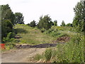


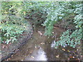
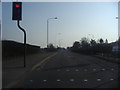
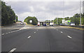
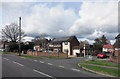
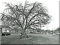
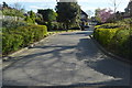
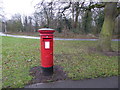

30 photos from this area
Area Information
Key information about the UB8 1PD including its size, population, and administrative classification.
- Area Type
- Postcode
- Area Size
- 4.8 hectares
- Population
- 2057
- Population Density
- 1730 people/km²
House Prices in UB8 1PD
33
Properties
£627,633
Average Sold Price
£170,000
Lowest Price
£1,638,000
Highest Price
Showing 33 properties
| Address | Type | Beds | Baths | Last Sale Price | Last Sale Date | |
|---|---|---|---|---|---|---|
| 13 North Common Road, Uxbridge, UB8 1PD | Terraced | 2 | 1 | £525,000 | Dec 2024 | |
| 13A North Common Road, Uxbridge, UB8 1PD | Detached | 4 | 2 | £1,357,500 | Jul 2024 | |
| 23 North Common Road, Uxbridge, UB8 1PD | house | - | - | £1,100,000 | Jun 2021 | |
| 5 North Common Road, Uxbridge, UB8 1PD | Land | - | - | £1,638,000 | Jul 2020 | |
| 12 North Common Road, Uxbridge, UB8 1PD | Terraced | 2 | 1 | £500,000 | Nov 2018 | |
| 8 North Common Road, Uxbridge, UB8 1PD | house | 4 | - | £980,000 | Sep 2015 | |
| 20 North Common Road, Uxbridge, UB8 1PD | house | 3 | - | £365,000 | Feb 2011 | |
| 22 North Common Road, Uxbridge, UB8 1PD | Bungalow | 3 | - | £370,000 | May 2010 | |
| 21 North Common Road, Uxbridge, UB8 1PD | Bungalow | - | - | £430,000 | Oct 2009 | |
| 11 North Common Road, Uxbridge, UB8 1PD | house | - | - | £450,000 | Jul 2009 |
Page 1 of 4
Energy Efficiency in UB8 1PD
Amenities
Schools
| Rank | School | Type | Entry gender | Ages |
|---|
Explore more schools in this area
Go to Schools tabDemographics
Household Size
Family (3-5 people)
most common
Accommodation Type
Houses
most common
Tenure
77
majority
Ethnic Group
White
most common
Religion
N/A
most common
Household Composition
N/A
most common
Age
47
median
Adults (30-64 years)
most common
Household Deprivation
N/A
with no deprivation
NS-SEC
49
in Lower managerial occupations
Explore more demographic insights in this area
Go to Demographics tabPlanning
Planning Constraints
- Flood RiskPremium
- Ramsar Wetland SitesPremium
- Area of Outstanding Natural BeautyPremium
- Protected Nature ReservePremium
- Protected WoodlandPremium