Area Overview for UB7 9LA
Photos of UB7 9LA
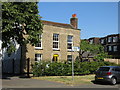
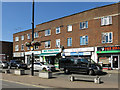
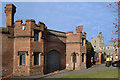
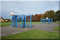

51 photos from this area
Area Information
Key information about the UB7 9LA including its size, population, and administrative classification.
- Area Type
- Postcode
- Area Size
- 1.1 hectares
- Population
- 1888
- Population Density
- 5397 people/km²
House Prices in UB7 9LA
28
Properties
£323,859
Average Sold Price
£81,500
Lowest Price
£491,000
Highest Price
Showing 28 properties
| Address | Type | Beds | Baths | Last Sale Price | Last Sale Date | |
|---|---|---|---|---|---|---|
| 3 Thornton Close, West Drayton, UB7 9LA | house | - | - | £475,000 | Aug 2023 | |
| 8 Thornton Close, West Drayton, UB7 9LA | Semi-detached | 3 | 1 | £452,000 | Dec 2022 | |
| 15 Thornton Close, West Drayton, UB7 9LA | Detached | 3 | 1 | £465,000 | May 2022 | |
| 9 Thornton Close, West Drayton, UB7 9LA | Retail | 3 | 1 | £440,000 | Mar 2022 | |
| 16 Thornton Close, West Drayton, UB7 9LA | Semi-detached | 5 | 2 | £491,000 | Aug 2019 | |
| 22 Thornton Close, West Drayton, UB7 9LA | house | 4 | 2 | £435,000 | Dec 2017 | |
| 14 Thornton Close, West Drayton, UB7 9LA | Semi-detached | 3 | 1 | £227,000 | Feb 2011 | |
| 10 Thornton Close, West Drayton, UB7 9LA | house | - | - | £187,000 | Jun 2003 | |
| 12 Thornton Close, West Drayton, UB7 9LA | house | - | - | £185,950 | Jul 2002 | |
| 18 Thornton Close, West Drayton, UB7 9LA | house | - | - | £123,000 | Jan 2001 |
Page 1 of 3
Energy Efficiency in UB7 9LA
Amenities
Schools
| Rank | School | Type | Entry gender | Ages |
|---|
Explore more schools in this area
Go to Schools tabDemographics
Household Size
Family (3-5 people)
most common
Accommodation Type
Houses
most common
Tenure
52
majority
Ethnic Group
White
most common
Religion
N/A
most common
Household Composition
N/A
most common
Age
47
median
Adults (30-64 years)
most common
Household Deprivation
N/A
with no deprivation
NS-SEC
21
in Lower managerial occupations
Explore more demographic insights in this area
Go to Demographics tabPlanning
Planning Constraints
- Flood RiskPremium
- Ramsar Wetland SitesPremium
- Area of Outstanding Natural BeautyPremium
- Protected Nature ReservePremium
- Protected WoodlandPremium