Area Overview for UB7 9EX
Photos of UB7 9EX

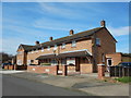

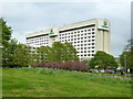
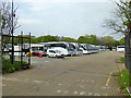
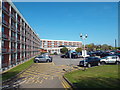
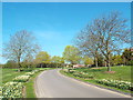
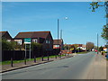
44 photos from this area
Area Information
Key information about the UB7 9EX including its size, population, and administrative classification.
- Area Type
- Postcode
- Area Size
- 2.3 hectares
- Population
- 1888
- Population Density
- 5397 people/km²
House Prices in UB7 9EX
30
Properties
£331,778
Average Sold Price
£15,000
Lowest Price
£552,000
Highest Price
Showing 30 properties
| Address | Type | Beds | Baths | Last Sale Price | Last Sale Date | |
|---|---|---|---|---|---|---|
| 39 Blackthorn Avenue, West Drayton, UB7 9EX | Terraced | 3 | 1 | £500,000 | Aug 2025 | |
| 58 Blackthorn Avenue, West Drayton, UB7 9EX | house | 4 | 2 | £550,000 | Sep 2024 | |
| 31 Blackthorn Avenue, West Drayton, UB7 9EX | Flat | 3 | 1 | £450,000 | Jan 2023 | |
| 48 Blackthorn Avenue, West Drayton, UB7 9EX | Terraced | 2 | - | £450,000 | Jan 2023 | |
| 50 Blackthorn Avenue, West Drayton, UB7 9EX | Terraced | 2 | 2 | £375,000 | Feb 2020 | |
| 30 Blackthorn Avenue, West Drayton, UB7 9EX | Semi-detached | 3 | 1 | £387,500 | May 2019 | |
| 33 Blackthorn Avenue, West Drayton, UB7 9EX | Semi-detached | 4 | 2 | £552,000 | Jun 2018 | |
| 46 Blackthorn Avenue, West Drayton, UB7 9EX | Semi-detached | - | - | £333,000 | Jan 2018 | |
| 38 Blackthorn Avenue, West Drayton, UB7 9EX | Terraced | 3 | 2 | £422,500 | Jun 2017 | |
| 40 Blackthorn Avenue, West Drayton, UB7 9EX | house | 1 | 1 | £15,000 | Jun 2016 |
Page 1 of 3
Energy Efficiency in UB7 9EX
Amenities
Schools
| Rank | School | Type | Entry gender | Ages |
|---|
Explore more schools in this area
Go to Schools tabDemographics
Household Size
Family (3-5 people)
most common
Accommodation Type
Houses
most common
Tenure
52
majority
Ethnic Group
White
most common
Religion
N/A
most common
Household Composition
N/A
most common
Age
47
median
Adults (30-64 years)
most common
Household Deprivation
N/A
with no deprivation
NS-SEC
21
in Lower managerial occupations
Explore more demographic insights in this area
Go to Demographics tabPlanning
Planning Constraints
- Flood RiskPremium
- Ramsar Wetland SitesPremium
- Area of Outstanding Natural BeautyPremium
- Protected Nature ReservePremium
- Protected WoodlandPremium