Area Overview for UB7 9EL
Photos of UB7 9EL
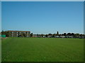
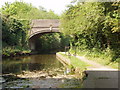
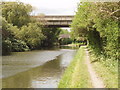
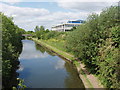
50 photos from this area
Area Information
Key information about the UB7 9EL including its size, population, and administrative classification.
- Area Type
- Postcode
- Area Size
- 1.7 hectares
- Population
- 2963
- Population Density
- 9946 people/km²
House Prices in UB7 9EL
23
Properties
£268,107
Average Sold Price
£60,000
Lowest Price
£545,000
Highest Price
Showing 23 properties
| Address | Type | Beds | Baths | Last Sale Price | Last Sale Date | |
|---|---|---|---|---|---|---|
| 22 Almond Avenue, West Drayton, UB7 9EL | Terraced | 3 | 1 | £545,000 | Oct 2022 | |
| 24 Almond Avenue, West Drayton, UB7 9EL | house | - | - | £363,000 | Aug 2019 | |
| 33 Almond Avenue, West Drayton, UB7 9EL | house | 3 | 1 | £385,000 | Apr 2017 | |
| 17 Almond Avenue, West Drayton, UB7 9EL | Terraced | 3 | 2 | £390,000 | May 2016 | |
| 29 Almond Avenue, West Drayton, UB7 9EL | Terraced | 3 | 1 | £352,000 | Mar 2016 | |
| 26 Almond Avenue, West Drayton, UB7 9EL | house | - | - | £245,000 | Mar 2013 | |
| 35 Almond Avenue, West Drayton, UB7 9EL | Detached | 3 | 2 | £247,000 | Jul 2012 | |
| 14 Almond Avenue, West Drayton, UB7 9EL | Semi-detached | - | - | £245,000 | Jan 2008 | |
| 23 Almond Avenue, West Drayton, UB7 9EL | Semi-detached | - | - | £215,000 | Aug 2006 | |
| 15 Almond Avenue, West Drayton, UB7 9EL | house | - | - | £211,500 | Feb 2005 |
Page 1 of 3
Energy Efficiency in UB7 9EL
Amenities
Schools
| Rank | School | Type | Entry gender | Ages |
|---|
Explore more schools in this area
Go to Schools tabDemographics
Household Size
Family (3-5 people)
most common
Accommodation Type
Houses
most common
Tenure
45
majority
Ethnic Group
White
most common
Religion
N/A
most common
Household Composition
N/A
most common
Age
47
median
Adults (30-64 years)
most common
Household Deprivation
N/A
with no deprivation
NS-SEC
33
in Lower managerial occupations
Explore more demographic insights in this area
Go to Demographics tabPlanning
Planning Constraints
- Flood RiskPremium
- Ramsar Wetland SitesPremium
- Area of Outstanding Natural BeautyPremium
- Protected Nature ReservePremium
- Protected WoodlandPremium