Area Overview for UB7 9EB
Photos of UB7 9EB
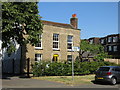
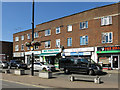
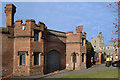
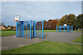
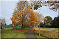
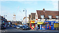
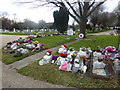
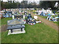
51 photos from this area
Area Information
Key information about the UB7 9EB including its size, population, and administrative classification.
- Area Type
- Postcode
- Area Size
- 3778 m²
- Population
- 2006
- Population Density
- 16138 people/km²
House Prices in UB7 9EB
14
Properties
£173,393
Average Sold Price
£35,000
Lowest Price
£415,000
Highest Price
Showing 14 properties
| Address | Type | Beds | Baths | Last Sale Price | Last Sale Date | |
|---|---|---|---|---|---|---|
| 54 Kingston Lane, West Drayton, UB7 9EB | Semi-detached | 1 | 1 | £290,000 | Jan 2025 | |
| 38 Kingston Lane, West Drayton, UB7 9EB | Terraced | 2 | 1 | £415,000 | Aug 2023 | |
| 56 Kingston Lane, West Drayton, UB7 9EB | Terraced | 1 | 1 | £285,000 | Nov 2022 | |
| 32 Kingston Lane, West Drayton, UB7 9EB | Semi-detached | 1 | 1 | £265,000 | Aug 2019 | |
| 42 Kingston Lane, West Drayton, UB7 9EB | Terraced | 3 | 1 | £295,000 | Jan 2015 | |
| 52 Kingston Lane, West Drayton, UB7 9EB | house | - | - | £60,000 | Mar 2010 | |
| 48 Kingston Lane, West Drayton, UB7 9EB | Semi-detached | - | - | £220,000 | Jun 2006 | |
| 34 Kingston Lane, West Drayton, UB7 9EB | Semi-detached | 1 | 1 | £123,500 | Nov 2005 | |
| 36 Kingston Lane, West Drayton, UB7 9EB | Semi-detached | - | - | £35,000 | Nov 2004 | |
| 50 Kingston Lane, West Drayton, UB7 9EB | house | - | - | £172,500 | Jan 2004 |
Page 1 of 2
Energy Efficiency in UB7 9EB
Amenities
Schools
| Rank | School | Type | Entry gender | Ages |
|---|
Explore more schools in this area
Go to Schools tabDemographics
Household Size
Family (3-5 people)
most common
Accommodation Type
Flats
most common
Tenure
29
majority
Ethnic Group
White
most common
Religion
N/A
most common
Household Composition
N/A
most common
Age
47
median
Adults (30-64 years)
most common
Household Deprivation
N/A
with no deprivation
NS-SEC
37
in Lower managerial occupations
Explore more demographic insights in this area
Go to Demographics tabPlanning
Planning Constraints
- Flood RiskPremium
- Ramsar Wetland SitesPremium
- Area of Outstanding Natural BeautyPremium
- Protected Nature ReservePremium
- Protected WoodlandPremium