Area Overview for UB7 9DB
Photos of UB7 9DB
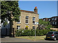
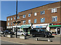
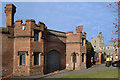
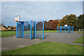
51 photos from this area
Area Information
Key information about the UB7 9DB including its size, population, and administrative classification.
- Area Type
- Postcode
- Area Size
- 5151 m²
- Population
- 2534
- Population Density
- 9864 people/km²
House Prices in UB7 9DB
19
Properties
£241,333
Average Sold Price
£140,000
Lowest Price
£401,000
Highest Price
Showing 19 properties
| Address | Type | Beds | Baths | Last Sale Price | Last Sale Date | |
|---|---|---|---|---|---|---|
| 51 Brandville Road, West Drayton, UB7 9DB | Maisonette | 2 | 1 | £250,000 | Oct 2019 | |
| 52 Brandville Road, West Drayton, UB7 9DB | house | 3 | - | £401,000 | Jan 2015 | |
| 50 Brandville Road, West Drayton, UB7 9DB | house | 4 | - | £365,000 | Nov 2012 | |
| 55 Brandville Road, West Drayton, UB7 9DB | Maisonette | 2 | 1 | £149,000 | Sep 2009 | |
| 57 Brandville Road, West Drayton, UB7 9DB | Maisonette | 2 | 1 | £180,000 | Jul 2008 | |
| 35 Brandville Road, West Drayton, UB7 9DB | house | 2 | 1 | £220,000 | Jun 2007 | |
| 37 Brandville Road, West Drayton, UB7 9DB | house | - | - | £250,000 | Oct 2006 | |
| 41 Brandville Road, West Drayton, UB7 9DB | Semi-detached | - | - | £217,000 | Feb 2005 | |
| 53 Brandville Road, West Drayton, UB7 9DB | Flat | - | - | £140,000 | Feb 2004 | |
| 47 Brandville Road, West Drayton, UB7 9DB | Terraced | 3 | 1 | - | - |
Page 1 of 2
Energy Efficiency in UB7 9DB
Amenities
Schools
| Rank | School | Type | Entry gender | Ages |
|---|
Explore more schools in this area
Go to Schools tabDemographics
Household Size
Family (3-5 people)
most common
Accommodation Type
Houses
most common
Tenure
43
majority
Ethnic Group
White
most common
Religion
N/A
most common
Household Composition
N/A
most common
Age
47
median
Adults (30-64 years)
most common
Household Deprivation
N/A
with no deprivation
NS-SEC
32
in Lower managerial occupations
Explore more demographic insights in this area
Go to Demographics tabPlanning
Planning Constraints
- Flood RiskPremium
- Ramsar Wetland SitesPremium
- Area of Outstanding Natural BeautyPremium
- Protected Nature ReservePremium
- Protected WoodlandPremium