Area Overview for UB7 9AS
Photos of UB7 9AS
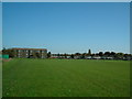
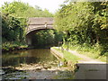
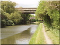
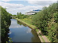
50 photos from this area
Area Information
Key information about the UB7 9AS including its size, population, and administrative classification.
- Area Type
- Postcode
- Area Size
- 1.1 hectares
- Population
- 2167
- Population Density
- 4659 people/km²
House Prices in UB7 9AS
36
Properties
£310,883
Average Sold Price
£79,000
Lowest Price
£615,000
Highest Price
Showing 36 properties
| Address | Type | Beds | Baths | Last Sale Price | Last Sale Date | |
|---|---|---|---|---|---|---|
| 50 Briar Way, West Drayton, UB7 9AS | Detached | 2 | - | £430,000 | Sep 2023 | |
| 57 Briar Way, West Drayton, UB7 9AS | Terraced | 4 | 2 | £615,000 | Aug 2023 | |
| 59 Briar Way, West Drayton, UB7 9AS | house | 3 | 1 | £340,000 | Sep 2022 | |
| 49 Briar Way, West Drayton, UB7 9AS | Terraced | 3 | 1 | £459,000 | Apr 2022 | |
| 46 Briar Way, West Drayton, UB7 9AS | house | - | - | £430,000 | Dec 2020 | |
| 53 Briar Way, West Drayton, UB7 9AS | house | - | - | £450,000 | Oct 2020 | |
| 31 Briar Way, West Drayton, UB7 9AS | house | 3 | 1 | £370,000 | Jan 2020 | |
| 52 Briar Way, West Drayton, UB7 9AS | Terraced | 2 | 1 | £390,000 | Jul 2019 | |
| 40 Briar Way, West Drayton, UB7 9AS | Terraced | 3 | 1 | £410,000 | Apr 2019 | |
| 43 Briar Way, West Drayton, UB7 9AS | Semi-detached | 3 | 1 | £250,000 | Aug 2013 |
Page 1 of 4
Energy Efficiency in UB7 9AS
Amenities
Schools
| Rank | School | Type | Entry gender | Ages |
|---|
Explore more schools in this area
Go to Schools tabDemographics
Household Size
Family (3-5 people)
most common
Accommodation Type
Houses
most common
Tenure
55
majority
Ethnic Group
White
most common
Religion
N/A
most common
Household Composition
N/A
most common
Age
47
median
Adults (30-64 years)
most common
Household Deprivation
N/A
with no deprivation
NS-SEC
35
in Lower managerial occupations
Explore more demographic insights in this area
Go to Demographics tabPlanning
Planning Constraints
- Flood RiskPremium
- Ramsar Wetland SitesPremium
- Area of Outstanding Natural BeautyPremium
- Protected Nature ReservePremium
- Protected WoodlandPremium