Area Overview for UB7 9AD
Photos of UB7 9AD
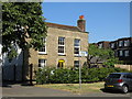
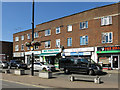
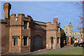
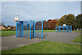

51 photos from this area
Area Information
Key information about the UB7 9AD including its size, population, and administrative classification.
- Area Type
- Postcode
- Area Size
- 7175 m²
- Population
- 2963
- Population Density
- 9946 people/km²
House Prices in UB7 9AD
18
Properties
£281,850
Average Sold Price
£200,000
Lowest Price
£450,000
Highest Price
Showing 18 properties
| Address | Type | Beds | Baths | Last Sale Price | Last Sale Date | |
|---|---|---|---|---|---|---|
| 88 Porters Way, West Drayton, UB7 9AD | house | 3 | - | £450,000 | Jun 2021 | |
| 82 Porters Way, West Drayton, UB7 9AD | Terraced | 3 | 1 | £408,000 | May 2018 | |
| 80 Porters Way, West Drayton, UB7 9AD | house | 3 | - | £225,000 | Jul 2010 | |
| 92 Porters Way, West Drayton, UB7 9AD | house | - | - | £230,000 | Jun 2009 | |
| 78 Porters Way, West Drayton, UB7 9AD | Semi-detached | - | - | £230,000 | Feb 2008 | |
| 90 Porters Way, West Drayton, UB7 9AD | house | - | - | £200,000 | Feb 2005 | |
| 86 Porters Way, West Drayton, UB7 9AD | house | - | - | £229,950 | Jun 2004 | |
| 76 Porters Way, West Drayton, UB7 9AD | Terraced | 3 | 1 | - | - | |
| 106 Porters Way, West Drayton, UB7 9AD | Flat | 1 | 1 | - | - | |
| 96 Porters Way, West Drayton, UB7 9AD | Semi-detached | - | - | - | - |
Page 1 of 2
Energy Efficiency in UB7 9AD
Amenities
Schools
| Rank | School | Type | Entry gender | Ages |
|---|
Explore more schools in this area
Go to Schools tabDemographics
Household Size
Family (3-5 people)
most common
Accommodation Type
Houses
most common
Tenure
45
majority
Ethnic Group
White
most common
Religion
N/A
most common
Household Composition
N/A
most common
Age
47
median
Adults (30-64 years)
most common
Household Deprivation
N/A
with no deprivation
NS-SEC
33
in Lower managerial occupations
Explore more demographic insights in this area
Go to Demographics tabPlanning
Planning Constraints
- Flood RiskPremium
- Ramsar Wetland SitesPremium
- Area of Outstanding Natural BeautyPremium
- Protected Nature ReservePremium
- Protected WoodlandPremium