Area Overview for UB7 7UY
Photos of UB7 7UY
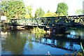
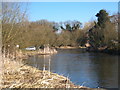
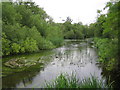
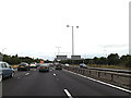
38 photos from this area
Area Information
Key information about the UB7 7UY including its size, population, and administrative classification.
- Area Type
- Postcode
- Area Size
- 5774 m²
- Population
- 1788
- Population Density
- 6664 people/km²
House Prices in UB7 7UY
20
Properties
£149,192
Average Sold Price
£60,000
Lowest Price
£240,000
Highest Price
Showing 20 properties
| Address | Type | Beds | Baths | Last Sale Price | Last Sale Date | |
|---|---|---|---|---|---|---|
| 10 Lupin Close, West Drayton, UB7 7UY | Maisonette | - | - | £195,000 | Nov 2021 | |
| 18 Lupin Close, West Drayton, UB7 7UY | Maisonette | 1 | 1 | £195,000 | May 2021 | |
| 6 Lupin Close, West Drayton, UB7 7UY | Flat | 1 | 1 | £224,000 | Dec 2019 | |
| 2 Lupin Close, West Drayton, UB7 7UY | Maisonette | 1 | 1 | £240,000 | Sep 2018 | |
| 12 Lupin Close, West Drayton, UB7 7UY | Maisonette | 1 | - | £175,000 | Jan 2016 | |
| 3 Lupin Close, West Drayton, UB7 7UY | Flat | 1 | 1 | £140,000 | Mar 2012 | |
| 17 Lupin Close, West Drayton, UB7 7UY | Maisonette | 1 | - | £130,000 | Feb 2011 | |
| 13 Lupin Close, West Drayton, UB7 7UY | Flat | - | - | £135,000 | Jan 2010 | |
| 8 Lupin Close, West Drayton, UB7 7UY | Flat | - | - | £128,500 | Dec 2005 | |
| 16 Lupin Close, West Drayton, UB7 7UY | Maisonette | 1 | - | £129,000 | Mar 2005 |
Page 1 of 2
Energy Efficiency in UB7 7UY
Amenities
Schools
| Rank | School | Type | Entry gender | Ages |
|---|
Explore more schools in this area
Go to Schools tabDemographics
Household Size
Family (3-5 people)
most common
Accommodation Type
Houses
most common
Tenure
39
majority
Ethnic Group
White
most common
Religion
N/A
most common
Household Composition
N/A
most common
Age
47
median
Adults (30-64 years)
most common
Household Deprivation
N/A
with no deprivation
NS-SEC
19
in Lower managerial occupations
Explore more demographic insights in this area
Go to Demographics tabPlanning
Planning Constraints
- Flood RiskPremium
- Ramsar Wetland SitesPremium
- Area of Outstanding Natural BeautyPremium
- Protected Nature ReservePremium
- Protected WoodlandPremium