Area Overview for UB7 7UR
Photos of UB7 7UR

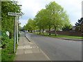
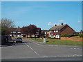
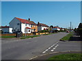
36 photos from this area
Area Information
Key information about the UB7 7UR including its size, population, and administrative classification.
- Area Type
- Postcode
- Area Size
- 8451 m²
- Population
- 1788
- Population Density
- 6664 people/km²
House Prices in UB7 7UR
26
Properties
£261,369
Average Sold Price
£56,250
Lowest Price
£500,000
Highest Price
Showing 26 properties
| Address | Type | Beds | Baths | Last Sale Price | Last Sale Date | |
|---|---|---|---|---|---|---|
| 72 Great Benty, West Drayton, UB7 7UR | Terraced | 3 | - | £500,000 | Nov 2023 | |
| 66 Great Benty, West Drayton, UB7 7UR | Semi-detached | 2 | 1 | £435,000 | Feb 2023 | |
| 64 Great Benty, West Drayton, UB7 7UR | Retail | 3 | 1 | £440,000 | Jun 2022 | |
| 80 Great Benty, West Drayton, UB7 7UR | Terraced | 3 | 1 | £385,000 | Mar 2019 | |
| 65 Great Benty, West Drayton, UB7 7UR | Terraced | 3 | 2 | £355,000 | Sep 2017 | |
| 75 Great Benty, West Drayton, UB7 7UR | house | 3 | 1 | £412,000 | Aug 2017 | |
| 78 Great Benty, West Drayton, UB7 7UR | Terraced | 2 | 1 | £167,300 | Sep 2015 | |
| 81 Great Benty, West Drayton, UB7 7UR | house | 3 | - | £236,000 | Sep 2011 | |
| 70 Great Benty, West Drayton, UB7 7UR | house | - | - | £210,000 | Feb 2008 | |
| 76 Great Benty, West Drayton, UB7 7UR | house | - | - | £210,000 | Feb 2008 |
Page 1 of 3
Energy Efficiency in UB7 7UR
Amenities
Schools
| Rank | School | Type | Entry gender | Ages |
|---|
Explore more schools in this area
Go to Schools tabDemographics
Household Size
Family (3-5 people)
most common
Accommodation Type
Houses
most common
Tenure
39
majority
Ethnic Group
White
most common
Religion
N/A
most common
Household Composition
N/A
most common
Age
47
median
Adults (30-64 years)
most common
Household Deprivation
N/A
with no deprivation
NS-SEC
19
in Lower managerial occupations
Explore more demographic insights in this area
Go to Demographics tabPlanning
Planning Constraints
- Flood RiskPremium
- Ramsar Wetland SitesPremium
- Area of Outstanding Natural BeautyPremium
- Protected Nature ReservePremium
- Protected WoodlandPremium