Area Overview for UB7 7LQ
Photos of UB7 7LQ

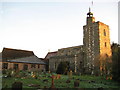
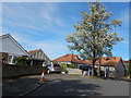
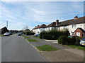
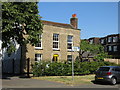
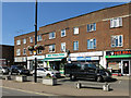

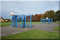
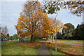
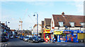

51 photos from this area
Area Information
Key information about the UB7 7LQ including its size, population, and administrative classification.
- Area Type
- Postcode
- Area Size
- 1.4 hectares
- Population
- 1802
- Population Density
- 3534 people/km²
House Prices in UB7 7LQ
48
Properties
£363,741
Average Sold Price
£147,000
Lowest Price
£575,000
Highest Price
Showing 48 properties
| Address | Type | Beds | Baths | Last Sale Price | Last Sale Date | |
|---|---|---|---|---|---|---|
| 19 Drayton Gardens, West Drayton, UB7 7LQ | Semi-detached | 1 | 2 | £575,000 | Sep 2024 | |
| 43 Drayton Gardens, West Drayton, UB7 7LQ | Semi-detached | 3 | 1 | £480,000 | Jul 2023 | |
| 29 Drayton Gardens, West Drayton, UB7 7LQ | Detached | 3 | 2 | £500,000 | Sep 2022 | |
| 63 Drayton Gardens, West Drayton, UB7 7LQ | Retail | 3 | 1 | £545,000 | Aug 2022 | |
| 33 Drayton Gardens, West Drayton, UB7 7LQ | Retail | 3 | 1 | £535,000 | May 2022 | |
| 72A Drayton Gardens, West Drayton, UB7 7LQ | Semi-detached | 2 | 1 | £365,000 | Jan 2022 | |
| 87 Drayton Gardens, West Drayton, UB7 7LQ | house | - | - | £467,000 | Jul 2021 | |
| 61 Drayton Gardens, West Drayton, UB7 7LQ | Semi-detached | 3 | 1 | £465,000 | Mar 2021 | |
| 66 Drayton Gardens, West Drayton, UB7 7LQ | house | - | - | £486,000 | Mar 2021 | |
| 23 Drayton Gardens, West Drayton, UB7 7LQ | Semi-detached | 3 | 1 | £415,000 | Jan 2020 |
Page 1 of 5
Energy Efficiency in UB7 7LQ
Amenities
Schools
| Rank | School | Type | Entry gender | Ages |
|---|
Explore more schools in this area
Go to Schools tabDemographics
Household Size
Family (3-5 people)
most common
Accommodation Type
Houses
most common
Tenure
68
majority
Ethnic Group
White
most common
Religion
N/A
most common
Household Composition
N/A
most common
Age
47
median
Adults (30-64 years)
most common
Household Deprivation
N/A
with no deprivation
NS-SEC
35
in Lower managerial occupations
Explore more demographic insights in this area
Go to Demographics tabPlanning
Planning Constraints
- Flood RiskPremium
- Ramsar Wetland SitesPremium
- Area of Outstanding Natural BeautyPremium
- Protected Nature ReservePremium
- Protected WoodlandPremium