Area Overview for UB7 7AA
Photos of UB7 7AA
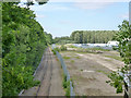
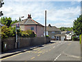
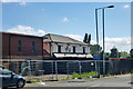
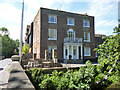
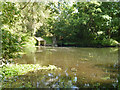
60 photos from this area
Area Information
Key information about the UB7 7AA including its size, population, and administrative classification.
- Area Type
- Postcode
- Area Size
- 2.0 hectares
- Population
- 1682
- Population Density
- 4920 people/km²
House Prices in UB7 7AA
43
Properties
£341,266
Average Sold Price
£85,000
Lowest Price
£575,000
Highest Price
Showing 43 properties
| Address | Type | Beds | Baths | Last Sale Price | Last Sale Date | |
|---|---|---|---|---|---|---|
| 20 Ferrers Avenue, West Drayton, UB7 7AA | house | 3 | 1 | £500,000 | Dec 2021 | |
| 26 Ferrers Avenue, West Drayton, UB7 7AA | house | - | - | £485,000 | Sep 2021 | |
| 11A Ferrers Avenue, West Drayton, UB7 7AA | Semi-detached | 3 | 2 | £450,000 | Mar 2019 | |
| 9 Ferrers Avenue, West Drayton, UB7 7AA | Detached | 4 | 1 | £575,000 | Aug 2018 | |
| 16 Ferrers Avenue, West Drayton, UB7 7AA | Semi-detached | 3 | - | £462,500 | Apr 2018 | |
| 25 Ferrers Avenue, West Drayton, UB7 7AA | Bungalow | 3 | 1 | £490,000 | Oct 2017 | |
| 30A Ferrers Avenue, West Drayton, UB7 7AA | Semi-detached | 3 | 1 | £455,000 | Jan 2017 | |
| 29 Ferrers Avenue, West Drayton, UB7 7AA | Semi-detached | 3 | - | £457,500 | Nov 2016 | |
| 26A Ferrers Avenue, West Drayton, UB7 7AA | Semi-detached | 4 | 2 | £475,000 | Mar 2016 | |
| 30 Ferrers Avenue, West Drayton, UB7 7AA | Semi-detached | 4 | - | £372,500 | Oct 2014 |
Page 1 of 5
Energy Efficiency in UB7 7AA
Amenities
Schools
| Rank | School | Type | Entry gender | Ages |
|---|
Explore more schools in this area
Go to Schools tabDemographics
Household Size
Family (3-5 people)
most common
Accommodation Type
Houses
most common
Tenure
60
majority
Ethnic Group
White
most common
Religion
N/A
most common
Household Composition
N/A
most common
Age
47
median
Adults (30-64 years)
most common
Household Deprivation
N/A
with no deprivation
NS-SEC
33
in Lower managerial occupations
Explore more demographic insights in this area
Go to Demographics tabPlanning
Planning Constraints
- Flood RiskPremium
- Ramsar Wetland SitesPremium
- Area of Outstanding Natural BeautyPremium
- Protected Nature ReservePremium
- Protected WoodlandPremium