Area Overview for UB6 9TL
Photos of UB6 9TL
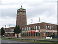
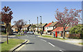

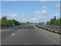
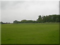
100 photos from this area
Area Information
Key information about the UB6 9TL including its size, population, and administrative classification.
- Area Type
- Postcode
- Area Size
- 1.1 hectares
- Population
- 1821
- Population Density
- 6000 people/km²
House Prices in UB6 9TL
33
Properties
£275,821
Average Sold Price
£71,000
Lowest Price
£635,000
Highest Price
Showing 33 properties
| Address | Type | Beds | Baths | Last Sale Price | Last Sale Date | |
|---|---|---|---|---|---|---|
| 82 Ferrymead Avenue, Greenford, UB6 9TL | Maisonette | 2 | 1 | £210,000 | Dec 2023 | |
| 67 Ferrymead Avenue, Greenford, UB6 9TL | Bungalow | 4 | 3 | £635,000 | Oct 2017 | |
| 82A Ferrymead Avenue, Greenford, UB6 9TL | Maisonette | 2 | 1 | £281,000 | Sep 2015 | |
| 80 Ferrymead Avenue, Greenford, UB6 9TL | Semi-detached | 3 | 1 | £490,000 | Jun 2015 | |
| 37 Ferrymead Avenue, Greenford, UB6 9TL | Terraced | 3 | - | £305,000 | Oct 2013 | |
| 78 Ferrymead Avenue, Greenford, UB6 9TL | Semi-detached | - | - | £315,000 | Apr 2012 | |
| 74 Ferrymead Avenue, Greenford, UB6 9TL | Flat | 3 | 1 | £290,000 | May 2010 | |
| 33 Ferrymead Avenue, Greenford, UB6 9TL | Bungalow | 7 | 4 | £315,000 | Feb 2010 | |
| 68 Ferrymead Avenue, Greenford, UB6 9TL | house | - | - | £320,000 | May 2007 | |
| 69 Ferrymead Avenue, Greenford, UB6 9TL | Unknown | - | - | £235,000 | Nov 2005 |
Page 1 of 4
Energy Efficiency in UB6 9TL
Amenities
Schools
| Rank | School | Type | Entry gender | Ages |
|---|
Explore more schools in this area
Go to Schools tabDemographics
Household Size
Family (3-5 people)
most common
Accommodation Type
Houses
most common
Tenure
62
majority
Ethnic Group
White
most common
Religion
N/A
most common
Household Composition
N/A
most common
Age
47
median
Adults (30-64 years)
most common
Household Deprivation
N/A
with no deprivation
NS-SEC
26
in Lower managerial occupations
Explore more demographic insights in this area
Go to Demographics tabPlanning
Planning Constraints
- Flood RiskPremium
- Ramsar Wetland SitesPremium
- Area of Outstanding Natural BeautyPremium
- Protected Nature ReservePremium
- Protected WoodlandPremium