Area Overview for UB6 9TA
Photos of UB6 9TA
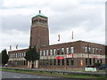
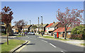

100 photos from this area
Area Information
Key information about the UB6 9TA including its size, population, and administrative classification.
- Area Type
- Postcode
- Area Size
- 5522 m²
- Population
- 1821
- Population Density
- 6000 people/km²
House Prices in UB6 9TA
18
Properties
£288,917
Average Sold Price
£174,000
Lowest Price
£370,500
Highest Price
Showing 18 properties
| Address | Type | Beds | Baths | Last Sale Price | Last Sale Date | |
|---|---|---|---|---|---|---|
| 28 Melrose Avenue, Greenford, UB6 9TA | Maisonette | 2 | 1 | £360,000 | Sep 2025 | |
| 16 Melrose Avenue, Greenford, UB6 9TA | Maisonette | 2 | 1 | £351,500 | May 2023 | |
| 20 Melrose Avenue, Greenford, UB6 9TA | Flat | 2 | 1 | £370,500 | Mar 2023 | |
| 14 Melrose Avenue, Greenford, UB6 9TA | Maisonette | 2 | 1 | £355,000 | Feb 2022 | |
| 10 Melrose Avenue, Greenford, UB6 9TA | Flat | 2 | - | £330,000 | Dec 2020 | |
| 24 Melrose Avenue, Greenford, UB6 9TA | Flat | - | - | £300,000 | Jun 2016 | |
| 8 Melrose Avenue, Greenford, UB6 9TA | Flat | 2 | 1 | £340,000 | Mar 2016 | |
| 4 Melrose Avenue, Greenford, UB6 9TA | Maisonette | 2 | 1 | £250,000 | Mar 2015 | |
| 18 Melrose Avenue, Greenford, UB6 9TA | Maisonette | 2 | 2 | £250,000 | Jan 2014 | |
| 32 Melrose Avenue, Greenford, UB6 9TA | Maisonette | - | - | £205,000 | Oct 2010 |
Page 1 of 2
Energy Efficiency in UB6 9TA
Amenities
Schools
| Rank | School | Type | Entry gender | Ages |
|---|
Explore more schools in this area
Go to Schools tabDemographics
Household Size
Family (3-5 people)
most common
Accommodation Type
Houses
most common
Tenure
62
majority
Ethnic Group
White
most common
Religion
N/A
most common
Household Composition
N/A
most common
Age
47
median
Adults (30-64 years)
most common
Household Deprivation
N/A
with no deprivation
NS-SEC
26
in Lower managerial occupations
Explore more demographic insights in this area
Go to Demographics tabPlanning
Planning Constraints
- Flood RiskPremium
- Ramsar Wetland SitesPremium
- Area of Outstanding Natural BeautyPremium
- Protected Nature ReservePremium
- Protected WoodlandPremium