Area Overview for UB6 8SB
Photos of UB6 8SB
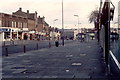
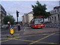
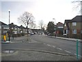
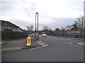
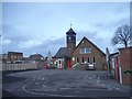
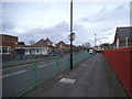
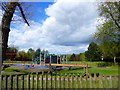
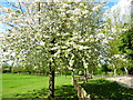
63 photos from this area
Area Information
Key information about the UB6 8SB including its size, population, and administrative classification.
- Area Type
- Postcode
- Area Size
- 1.8 hectares
- Population
- 2039
- Population Density
- 7605 people/km²
House Prices in UB6 8SB
58
Properties
£369,409
Average Sold Price
£95,000
Lowest Price
£675,000
Highest Price
Showing 58 properties
| Address | Type | Beds | Baths | Last Sale Price | Last Sale Date | |
|---|---|---|---|---|---|---|
| 19 WEDMORE ROAD, Greenford, UB6 8SB | Detached | 3 | 1 | £550,000 | Jul 2023 | |
| 17 WEDMORE ROAD, Greenford, UB6 8SB | Semi-detached | 5 | 3 | £675,000 | Feb 2023 | |
| 46 Wedmore Road, Greenford, UB6 8SB | Flat | 2 | 1 | £285,000 | Jul 2022 | |
| 12 Wedmore Road, Greenford, UB6 8SB | Maisonette | 2 | 1 | £305,000 | Dec 2021 | |
| 12A Wedmore Road, Greenford, UB6 8SB | Flat | - | 1 | £327,000 | Dec 2020 | |
| 33 Wedmore Road, Greenford, UB6 8SB | Semi-detached | 3 | 1 | £475,000 | Dec 2018 | |
| 22 Wedmore Road, Greenford, UB6 8SB | Semi-detached | 5 | 2 | £602,500 | Jul 2018 | |
| 39 Wedmore Road, Greenford, UB6 8SB | house | - | - | £489,950 | May 2017 | |
| 32 Wedmore Road, Greenford, UB6 8SB | Semi-detached | 4 | 2 | £550,000 | Aug 2016 | |
| 41 Wedmore Road, Greenford, UB6 8SB | house | - | - | £440,000 | Dec 2014 |
Page 1 of 6
Energy Efficiency in UB6 8SB
Amenities
Schools
| Rank | School | Type | Entry gender | Ages |
|---|
Explore more schools in this area
Go to Schools tabDemographics
Household Size
Family (3-5 people)
most common
Accommodation Type
Houses
most common
Tenure
60
majority
Ethnic Group
White
most common
Religion
N/A
most common
Household Composition
N/A
most common
Age
47
median
Adults (30-64 years)
most common
Household Deprivation
N/A
with no deprivation
NS-SEC
27
in Lower managerial occupations
Explore more demographic insights in this area
Go to Demographics tabPlanning
Planning Constraints
- Flood RiskPremium
- Ramsar Wetland SitesPremium
- Area of Outstanding Natural BeautyPremium
- Protected Nature ReservePremium
- Protected WoodlandPremium