Area Overview for UB6 8LX
Photos of UB6 8LX
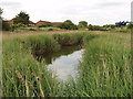


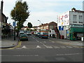
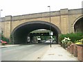

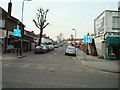
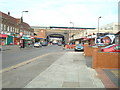
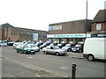
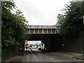
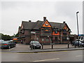
100 photos from this area
Area Information
Key information about the UB6 8LX including its size, population, and administrative classification.
- Area Type
- Postcode
- Area Size
- 1.2 hectares
- Population
- 1720
- Population Density
- 3139 people/km²
House Prices in UB6 8LX
45
Properties
£202,994
Average Sold Price
£56,000
Lowest Price
£485,000
Highest Price
Showing 45 properties
| Address | Type | Beds | Baths | Last Sale Price | Last Sale Date | |
|---|---|---|---|---|---|---|
| 89 Birkbeck Avenue, Greenford, UB6 8LX | Maisonette | 2 | 1 | £317,500 | Jan 2022 | |
| 101 Birkbeck Avenue, Greenford, UB6 8LX | Maisonette | 4 | 1 | £334,950 | Aug 2020 | |
| 93 Birkbeck Avenue, Greenford, UB6 8LX | Maisonette | 2 | 1 | £315,000 | Mar 2020 | |
| 97 Birkbeck Avenue, Greenford, UB6 8LX | Flat | 2 | 1 | £270,000 | Mar 2019 | |
| 81 Birkbeck Avenue, Greenford, UB6 8LX | Maisonette | 2 | 1 | £305,000 | Jun 2018 | |
| 99 Birkbeck Avenue, Greenford, UB6 8LX | Flat | - | - | £300,000 | Feb 2018 | |
| 82 Birkbeck Avenue, Greenford, UB6 8LX | Terraced | 3 | 1 | £485,000 | Nov 2017 | |
| 87 Birkbeck Avenue, Greenford, UB6 8LX | Flat | 2 | 1 | £170,000 | May 2016 | |
| 91A Birkbeck Avenue, Greenford, UB6 8LX | Maisonette | 2 | 1 | £295,000 | Feb 2016 | |
| 72 Birkbeck Avenue, Greenford, UB6 8LX | Terraced | 4 | 2 | £315,000 | Sep 2013 |
Page 1 of 5
Energy Efficiency in UB6 8LX
Amenities
Schools
| Rank | School | Type | Entry gender | Ages |
|---|
Explore more schools in this area
Go to Schools tabDemographics
Household Size
Family (3-5 people)
most common
Accommodation Type
Houses
most common
Tenure
51
majority
Ethnic Group
White
most common
Religion
N/A
most common
Household Composition
N/A
most common
Age
47
median
Adults (30-64 years)
most common
Household Deprivation
N/A
with no deprivation
NS-SEC
27
in Lower managerial occupations
Explore more demographic insights in this area
Go to Demographics tabPlanning
Planning Constraints
- Flood RiskPremium
- Ramsar Wetland SitesPremium
- Area of Outstanding Natural BeautyPremium
- Protected Nature ReservePremium
- Protected WoodlandPremium