Area Overview for UB6 8LE
Photos of UB6 8LE
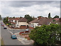
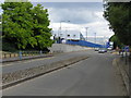
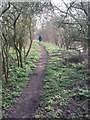

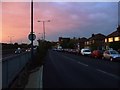
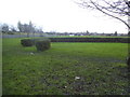
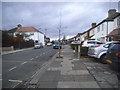
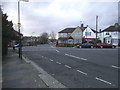
84 photos from this area
Area Information
Key information about the UB6 8LE including its size, population, and administrative classification.
- Area Type
- Postcode
- Area Size
- 3177 m²
- Population
- 1958
- Population Density
- 8508 people/km²
House Prices in UB6 8LE
10
Properties
£288,375
Average Sold Price
£125,000
Lowest Price
£600,000
Highest Price
Showing 10 properties
| Address | Type | Beds | Baths | Last Sale Price | Last Sale Date | |
|---|---|---|---|---|---|---|
| 5 Woodhouse Avenue, Perivale, UB6 8LE | house | 1 | 1 | £600,000 | Jan 2025 | |
| 7 Woodhouse Avenue, Perivale, UB6 8LE | Terraced | 3 | 1 | £470,000 | Jan 2025 | |
| 23 Woodhouse Avenue, Perivale, UB6 8LE | house | 3 | - | £281,000 | Jul 2012 | |
| 27 Woodhouse Avenue, Perivale, UB6 8LE | house | - | - | £249,000 | Oct 2011 | |
| 9 Woodhouse Avenue, Perivale, UB6 8LE | Terraced | - | - | £249,000 | Jul 2006 | |
| 11 Woodhouse Avenue, Perivale, UB6 8LE | Terraced | 5 | 1 | £158,000 | Jun 2001 | |
| 21 Woodhouse Avenue, Perivale, UB6 8LE | Terraced | - | - | £175,000 | Feb 2000 | |
| 3 Woodhouse Avenue, Perivale, UB6 8LE | Semi-detached | - | - | £125,000 | Nov 1998 | |
| 1 Woodhouse Avenue, Perivale, UB6 8LE | Semi-detached | - | - | - | - | |
| 25 Woodhouse Avenue, Perivale, UB6 8LE | house | - | - | - | - |
Energy Efficiency in UB6 8LE
Amenities
Schools
| Rank | School | Type | Entry gender | Ages |
|---|
Explore more schools in this area
Go to Schools tabDemographics
Household Size
Family (3-5 people)
most common
Accommodation Type
Houses
most common
Tenure
64
majority
Ethnic Group
White
most common
Religion
N/A
most common
Household Composition
N/A
most common
Age
47
median
Adults (30-64 years)
most common
Household Deprivation
N/A
with no deprivation
NS-SEC
30
in Lower managerial occupations
Explore more demographic insights in this area
Go to Demographics tabPlanning
Planning Constraints
- Flood RiskPremium
- Ramsar Wetland SitesPremium
- Area of Outstanding Natural BeautyPremium
- Protected Nature ReservePremium
- Protected WoodlandPremium