Area Overview for UB6 7ET
Photos of UB6 7ET
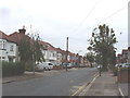

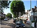
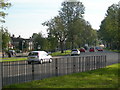
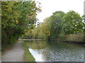

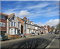
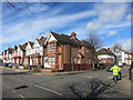
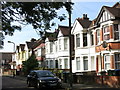


68 photos from this area
Area Information
Key information about the UB6 7ET including its size, population, and administrative classification.
- Area Type
- Postcode
- Area Size
- 7241 m²
- Population
- 1792
- Population Density
- 7819 people/km²
House Prices in UB6 7ET
24
Properties
£289,425
Average Sold Price
£64,500
Lowest Price
£678,000
Highest Price
Showing 24 properties
| Address | Type | Beds | Baths | Last Sale Price | Last Sale Date | |
|---|---|---|---|---|---|---|
| 36 Launceston Gardens, Perivale, UB6 7ET | Terraced | 4 | 2 | £678,000 | May 2024 | |
| 10 Launceston Gardens, Perivale, UB6 7ET | house | 3 | - | £538,000 | Oct 2021 | |
| 6 Launceston Gardens, Perivale, UB6 7ET | Terraced | 4 | - | £500,000 | Jul 2019 | |
| 16 Launceston Gardens, Perivale, UB6 7ET | Terraced | 3 | - | £472,000 | Sep 2018 | |
| 42 Launceston Gardens, Perivale, UB6 7ET | Terraced | - | - | £250,000 | Aug 2004 | |
| 4 Launceston Gardens, Perivale, UB6 7ET | Semi-detached | - | - | £262,500 | Nov 2003 | |
| 26 Launceston Gardens, Perivale, UB6 7ET | Terraced | 3 | 1 | £238,000 | Jul 2003 | |
| 38 Launceston Gardens, Perivale, UB6 7ET | Terraced | - | - | £277,000 | Sep 2002 | |
| 22 Launceston Gardens, Perivale, UB6 7ET | Terraced | - | - | £236,000 | Aug 2002 | |
| 8 Launceston Gardens, Perivale, UB6 7ET | Terraced | 2 | 1 | £165,000 | Aug 2001 |
Page 1 of 3
Energy Efficiency in UB6 7ET
Amenities
Schools
| Rank | School | Type | Entry gender | Ages |
|---|
Explore more schools in this area
Go to Schools tabDemographics
Household Size
Family (3-5 people)
most common
Accommodation Type
Houses
most common
Tenure
60
majority
Ethnic Group
asian_total
most common
Religion
N/A
most common
Household Composition
N/A
most common
Age
47
median
Adults (30-64 years)
most common
Household Deprivation
N/A
with no deprivation
NS-SEC
26
in Lower managerial occupations
Explore more demographic insights in this area
Go to Demographics tabPlanning
Planning Constraints
- Flood RiskPremium
- Ramsar Wetland SitesPremium
- Area of Outstanding Natural BeautyPremium
- Protected Nature ReservePremium
- Protected WoodlandPremium