Area Overview for UB6 7EG
Photos of UB6 7EG
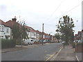

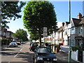
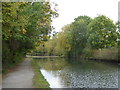

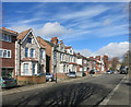
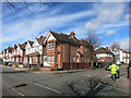
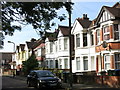


68 photos from this area
Area Information
Key information about the UB6 7EG including its size, population, and administrative classification.
- Area Type
- Postcode
- Area Size
- 1.6 hectares
- Population
- 1896
- Population Density
- 9984 people/km²
House Prices in UB6 7EG
37
Properties
£293,346
Average Sold Price
£65,500
Lowest Price
£530,000
Highest Price
Showing 37 properties
| Address | Type | Beds | Baths | Last Sale Price | Last Sale Date | |
|---|---|---|---|---|---|---|
| 94 Empire Road, Perivale, UB6 7EG | house | - | - | £364,500 | Mar 2025 | |
| 134 Empire Road, Perivale, UB6 7EG | Retail | 2 | 1 | £440,000 | Nov 2022 | |
| 136 Empire Road, Perivale, UB6 7EG | Terraced | 2 | - | £440,000 | Feb 2022 | |
| 104 EMPIRE ROAD, Perivale, UB6 7EG | Flat | 4 | 1 | £530,000 | Oct 2021 | |
| 124 Empire Road, Perivale, UB6 7EG | Terraced | 2 | 1 | £353,000 | Feb 2020 | |
| 120 Empire Road, Perivale, UB6 7EG | house | - | - | £160,000 | Jun 2016 | |
| 82 Empire Road, Perivale, UB6 7EG | Terraced | 3 | 1 | £442,000 | Feb 2016 | |
| 98 Empire Road, Perivale, UB6 7EG | Terraced | 2 | 1 | £399,950 | Aug 2015 | |
| 128 Empire Road, Perivale, UB6 7EG | house | - | - | £320,000 | Nov 2014 | |
| 84 Empire Road, Perivale, UB6 7EG | Terraced | 4 | 2 | £475,000 | Jan 2014 |
Page 1 of 4
Energy Efficiency in UB6 7EG
Amenities
Schools
| Rank | School | Type | Entry gender | Ages |
|---|
Explore more schools in this area
Go to Schools tabDemographics
Household Size
Family (3-5 people)
most common
Accommodation Type
Houses
most common
Tenure
55
majority
Ethnic Group
asian_total
most common
Religion
N/A
most common
Household Composition
N/A
most common
Age
47
median
Adults (30-64 years)
most common
Household Deprivation
N/A
with no deprivation
NS-SEC
24
in Lower managerial occupations
Explore more demographic insights in this area
Go to Demographics tabPlanning
Planning Constraints
- Flood RiskPremium
- Ramsar Wetland SitesPremium
- Area of Outstanding Natural BeautyPremium
- Protected Nature ReservePremium
- Protected WoodlandPremium