Area Overview for UB4 9JD
Photos of UB4 9JD
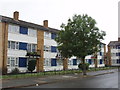
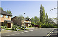
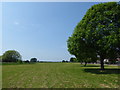

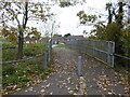
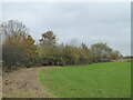
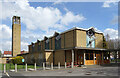

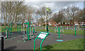
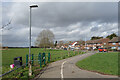
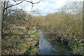
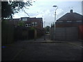
32 photos from this area
Area Information
Key information about the UB4 9JD including its size, population, and administrative classification.
- Area Type
- Postcode
- Area Size
- 5973 m²
- Population
- 1760
- Population Density
- 3759 people/km²
House Prices in UB4 9JD
20
Properties
£245,383
Average Sold Price
£58,000
Lowest Price
£425,000
Highest Price
Showing 20 properties
| Address | Type | Beds | Baths | Last Sale Price | Last Sale Date | |
|---|---|---|---|---|---|---|
| 21 Attlee Road, Hayes, UB4 9JD | Terraced | 2 | 1 | £425,000 | Jul 2024 | |
| 26 Attlee Road, Hayes, UB4 9JD | Semi-detached | 2 | 1 | £395,000 | Oct 2020 | |
| 18 Attlee Road, Hayes, UB4 9JD | Terraced | 2 | - | £415,000 | Jul 2020 | |
| 28 Attlee Road, Hayes, UB4 9JD | Semi-detached | 2 | 1 | £290,000 | Jun 2014 | |
| 22 Attlee Road, Hayes, UB4 9JD | house | - | - | £198,500 | Jun 2005 | |
| 44 Attlee Road, Hayes, UB4 9JD | house | - | - | £195,000 | Nov 2002 | |
| 38 Attlee Road, Hayes, UB4 9JD | house | - | - | £125,000 | Oct 2000 | |
| 15 Attlee Road, Hayes, UB4 9JD | Terraced | 2 | 1 | £106,950 | Sep 1999 | |
| 17 Attlee Road, Hayes, UB4 9JD | Terraced | 2 | - | £58,000 | Feb 1995 | |
| 36 Attlee Road, Hayes, UB4 9JD | house | - | - | - | - |
Page 1 of 2
Energy Efficiency in UB4 9JD
Amenities
Schools
| Rank | School | Type | Entry gender | Ages |
|---|
Explore more schools in this area
Go to Schools tabDemographics
Household Size
Family (3-5 people)
most common
Accommodation Type
Houses
most common
Tenure
35
majority
Ethnic Group
White
most common
Religion
N/A
most common
Household Composition
N/A
most common
Age
47
median
Adults (30-64 years)
most common
Household Deprivation
N/A
with no deprivation
NS-SEC
20
in Lower managerial occupations
Explore more demographic insights in this area
Go to Demographics tabPlanning
Planning Constraints
- Flood RiskPremium
- Ramsar Wetland SitesPremium
- Area of Outstanding Natural BeautyPremium
- Protected Nature ReservePremium
- Protected WoodlandPremium