Area Overview for UB4 8SS
Photos of UB4 8SS
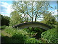
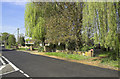
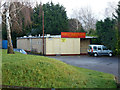
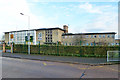
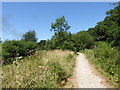
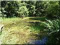
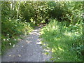
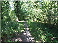
40 photos from this area
Area Information
Key information about the UB4 8SS including its size, population, and administrative classification.
- Area Type
- Postcode
- Area Size
- 2.5 hectares
- Population
- 1565
- Population Density
- 2679 people/km²
House Prices in UB4 8SS
43
Properties
£265,598
Average Sold Price
£84,000
Lowest Price
£559,000
Highest Price
Showing 43 properties
| Address | Type | Beds | Baths | Last Sale Price | Last Sale Date | |
|---|---|---|---|---|---|---|
| 71 Langdale Drive, Hayes, UB4 8SS | Semi-detached | 3 | 2 | £559,000 | Oct 2024 | |
| 25 Langdale Drive, Hayes, UB4 8SS | Flat | 2 | 1 | £270,000 | Jun 2022 | |
| 37 Langdale Drive, Hayes, UB4 8SS | Maisonette | 2 | 1 | £242,500 | Mar 2020 | |
| 9 Langdale Drive, Hayes, UB4 8SS | Semi-detached | 3 | 1 | £415,000 | Apr 2019 | |
| 69 Langdale Drive, Hayes, UB4 8SS | house | - | - | £410,000 | Apr 2018 | |
| 79 Langdale Drive, Hayes, UB4 8SS | house | - | - | £400,000 | Sep 2017 | |
| 21 Langdale Drive, Hayes, UB4 8SS | Maisonette | 2 | 1 | £255,000 | Dec 2016 | |
| 43 Langdale Drive, Hayes, UB4 8SS | Maisonette | 2 | 1 | £275,000 | May 2016 | |
| 13 Langdale Drive, Hayes, UB4 8SS | Semi-detached | 3 | - | £305,000 | Aug 2014 | |
| 51 Langdale Drive, Hayes, UB4 8SS | Semi-detached | 3 | - | £273,000 | Nov 2013 |
Page 1 of 5
Energy Efficiency in UB4 8SS
Amenities
Schools
| Rank | School | Type | Entry gender | Ages |
|---|
Explore more schools in this area
Go to Schools tabDemographics
Household Size
Family (3-5 people)
most common
Accommodation Type
Houses
most common
Tenure
78
majority
Ethnic Group
White
most common
Religion
N/A
most common
Household Composition
N/A
most common
Age
47
median
Adults (30-64 years)
most common
Household Deprivation
N/A
with no deprivation
NS-SEC
26
in Lower managerial occupations
Explore more demographic insights in this area
Go to Demographics tabPlanning
Planning Constraints
- Flood RiskPremium
- Ramsar Wetland SitesPremium
- Area of Outstanding Natural BeautyPremium
- Protected Nature ReservePremium
- Protected WoodlandPremium