Area Overview for UB3 2PA
Photos of UB3 2PA
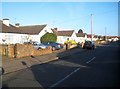

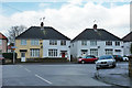


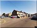
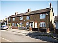
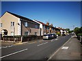
38 photos from this area
Area Information
Key information about the UB3 2PA including its size, population, and administrative classification.
- Area Type
- Postcode
- Area Size
- 6300 m²
- Population
- 2474
- Population Density
- 12110 people/km²
House Prices in UB3 2PA
21
Properties
£275,359
Average Sold Price
£188,000
Lowest Price
£411,000
Highest Price
Showing 21 properties
| Address | Type | Beds | Baths | Last Sale Price | Last Sale Date | |
|---|---|---|---|---|---|---|
| 93 Judge Heath Lane, Hayes, UB3 2PA | Semi-detached | 3 | 1 | £411,000 | Jul 2019 | |
| 97 Judge Heath Lane, Hayes, UB3 2PA | house | - | - | £395,000 | Mar 2018 | |
| 71 Judge Heath Lane, Hayes, UB3 2PA | Terraced | 4 | 2 | £350,000 | Jun 2015 | |
| 73 Judge Heath Lane, Hayes, UB3 2PA | Terraced | 3 | 1 | £320,000 | Oct 2014 | |
| 83 Judge Heath Lane, Hayes, UB3 2PA | house | - | - | £260,000 | Jul 2012 | |
| 65 Judge Heath Lane, Hayes, UB3 2PA | Semi-detached | 3 | - | £227,000 | Dec 2010 | |
| 91 Judge Heath Lane, Hayes, UB3 2PA | house | - | - | £220,000 | Sep 2009 | |
| The Bourne, 71A Judge Heath Lane, Hayes, UB3 2PA | Semi-detached | - | - | £249,950 | Jan 2006 | |
| 79 Judge Heath Lane, Hayes, UB3 2PA | house | - | - | £190,000 | Nov 2003 | |
| 69 Judge Heath Lane, Hayes, UB3 2PA | Semi-detached | - | - | £218,000 | Aug 2003 |
Page 1 of 3
Energy Efficiency in UB3 2PA
Amenities
Schools
| Rank | School | Type | Entry gender | Ages |
|---|
Explore more schools in this area
Go to Schools tabDemographics
Household Size
Family (3-5 people)
most common
Accommodation Type
Houses
most common
Tenure
49
majority
Ethnic Group
asian_total
most common
Religion
N/A
most common
Household Composition
N/A
most common
Age
47
median
Adults (30-64 years)
most common
Household Deprivation
N/A
with no deprivation
NS-SEC
22
in Lower managerial occupations
Explore more demographic insights in this area
Go to Demographics tabPlanning
Planning Constraints
- Flood RiskPremium
- Ramsar Wetland SitesPremium
- Area of Outstanding Natural BeautyPremium
- Protected Nature ReservePremium
- Protected WoodlandPremium