Area Overview for UB3 1TR
Photos of UB3 1TR
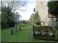
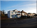
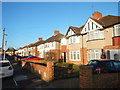

39 photos from this area
Area Information
Key information about the UB3 1TR including its size, population, and administrative classification.
- Area Type
- Postcode
- Area Size
- 4822 m²
- Population
- 1767
- Population Density
- 5849 people/km²
House Prices in UB3 1TR
15
Properties
£271,778
Average Sold Price
£74,000
Lowest Price
£448,000
Highest Price
Showing 15 properties
| Address | Type | Beds | Baths | Last Sale Price | Last Sale Date | |
|---|---|---|---|---|---|---|
| 86 Mildred Avenue, Hayes, UB3 1TR | house | - | - | £380,000 | Sep 2020 | |
| 92 Mildred Avenue, Hayes, UB3 1TR | Terraced | 3 | 2 | £425,000 | Jan 2020 | |
| 73 Mildred Avenue, Hayes, UB3 1TR | house | 3 | 2 | £448,000 | Mar 2016 | |
| 88 Mildred Avenue, Hayes, UB3 1TR | house | 3 | 1 | £228,000 | Oct 2011 | |
| 81 Mildred Avenue, Hayes, UB3 1TR | house | 4 | - | £340,000 | Aug 2011 | |
| 82 Mildred Avenue, Hayes, UB3 1TR | house | - | - | £225,000 | May 2009 | |
| 78 Mildred Avenue, Hayes, UB3 1TR | Semi-detached | - | - | £226,000 | Jun 2006 | |
| 80 Mildred Avenue, Hayes, UB3 1TR | Semi-detached | - | - | £74,000 | Oct 1997 | |
| 74 Mildred Avenue, Hayes, UB3 1TR | Semi-detached | 3 | 1 | £100,000 | Apr 1997 | |
| 79 Mildred Avenue, Hayes, UB3 1TR | Terraced | 4 | 1 | - | - |
Page 1 of 2
Energy Efficiency in UB3 1TR
Amenities
Schools
| Rank | School | Type | Entry gender | Ages |
|---|
Explore more schools in this area
Go to Schools tabDemographics
Household Size
Family (3-5 people)
most common
Accommodation Type
Houses
most common
Tenure
62
majority
Ethnic Group
asian_total
most common
Religion
N/A
most common
Household Composition
N/A
most common
Age
47
median
Adults (30-64 years)
most common
Household Deprivation
N/A
with no deprivation
NS-SEC
22
in Lower managerial occupations
Explore more demographic insights in this area
Go to Demographics tabPlanning
Planning Constraints
- Flood RiskPremium
- Ramsar Wetland SitesPremium
- Area of Outstanding Natural BeautyPremium
- Protected Nature ReservePremium
- Protected WoodlandPremium