Area Overview for UB2 5DD
Photos of UB2 5DD
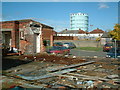
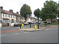
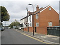
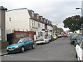
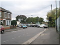
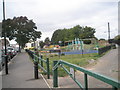
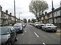
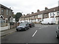
96 photos from this area
Area Information
Key information about the UB2 5DD including its size, population, and administrative classification.
- Area Type
- Postcode
- Area Size
- 1.1 hectares
- Population
- 1764
- Population Density
- 13706 people/km²
House Prices in UB2 5DD
34
Properties
£224,217
Average Sold Price
£83,000
Lowest Price
£425,000
Highest Price
Showing 34 properties
| Address | Type | Beds | Baths | Last Sale Price | Last Sale Date | |
|---|---|---|---|---|---|---|
| 1 Scotts Road, Southall, UB2 5DD | house | - | - | £425,000 | Feb 2021 | |
| 31 Scotts Road, Southall, UB2 5DD | Terraced | 3 | 2 | £399,950 | Mar 2016 | |
| 19 Scotts Road, Southall, UB2 5DD | house | - | - | £320,000 | Nov 2014 | |
| 17 Scotts Road, Southall, UB2 5DD | Semi-detached | 3 | - | £230,000 | Mar 2012 | |
| 11 Scotts Road, Southall, UB2 5DD | Terraced | 3 | 1 | £120,000 | May 2007 | |
| 45 Scotts Road, Southall, UB2 5DD | house | - | - | £148,000 | Jan 2002 | |
| 23 Scotts Road, Southall, UB2 5DD | Terraced | - | - | £147,000 | Dec 2001 | |
| 35 Scotts Road, Southall, UB2 5DD | Terraced | - | - | £145,000 | Sep 2001 | |
| 3 Scotts Road, Southall, UB2 5DD | Semi-detached | - | - | £83,000 | Jun 1998 | |
| 41 Scotts Road, Southall, UB2 5DD | Terraced | 4 | - | - | - |
Page 1 of 4
Energy Efficiency in UB2 5DD
Amenities
Schools
| Rank | School | Type | Entry gender | Ages |
|---|
Explore more schools in this area
Go to Schools tabDemographics
Household Size
Family (3-5 people)
most common
Accommodation Type
Houses
most common
Tenure
50
majority
Ethnic Group
asian_total
most common
Religion
N/A
most common
Household Composition
N/A
most common
Age
47
median
Adults (30-64 years)
most common
Household Deprivation
N/A
with no deprivation
NS-SEC
16
in Lower managerial occupations
Explore more demographic insights in this area
Go to Demographics tabPlanning
Planning Constraints
- Flood RiskPremium
- Ramsar Wetland SitesPremium
- Area of Outstanding Natural BeautyPremium
- Protected Nature ReservePremium
- Protected WoodlandPremium