Area Overview for UB2 5BH
Photos of UB2 5BH
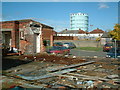
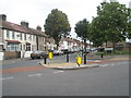
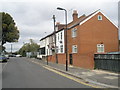
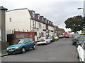
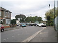
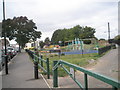
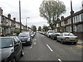
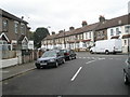
96 photos from this area
Area Information
Key information about the UB2 5BH including its size, population, and administrative classification.
- Area Type
- Postcode
- Area Size
- 1.3 hectares
- Population
- 2050
- Population Density
- 12031 people/km²
House Prices in UB2 5BH
30
Properties
£133,350
Average Sold Price
£45,500
Lowest Price
£225,000
Highest Price
Showing 30 properties
| Address | Type | Beds | Baths | Last Sale Price | Last Sale Date | |
|---|---|---|---|---|---|---|
| First Floor Flat, 13 Spencer Street, Southall, UB2 5BH | Maisonette | 2 | 1 | £195,000 | Oct 2020 | |
| 40 Spencer Street, Southall, UB2 5BH | Terraced | 3 | 1 | £225,000 | Mar 2013 | |
| 17 Spencer Street, Southall, UB2 5BH | Terraced | 3 | 1 | £183,000 | Feb 2012 | |
| 11 Spencer Street, Southall, UB2 5BH | Maisonette | 3 | 1 | £122,000 | Oct 2007 | |
| 11A Spencer Street, Southall, UB2 5BH | Flat | 3 | 1 | £135,000 | Mar 2004 | |
| 34 Spencer Street, Southall, UB2 5BH | house | 3 | 1 | £180,500 | Jul 2003 | |
| 54 Spencer Street, Southall, UB2 5BH | Terraced | 3 | 1 | £125,000 | Jun 2002 | |
| 15 Spencer Street, Southall, UB2 5BH | Terraced | 3 | 1 | £76,000 | Aug 1997 | |
| 21 Spencer Street, Southall, UB2 5BH | Terraced | 5 | 2 | £46,500 | Jun 1996 | |
| 7 Spencer Street, Southall, UB2 5BH | Terraced | - | - | £45,500 | Feb 1996 |
Page 1 of 3
Energy Efficiency in UB2 5BH
Amenities
Schools
| Rank | School | Type | Entry gender | Ages |
|---|
Explore more schools in this area
Go to Schools tabDemographics
Household Size
Family (3-5 people)
most common
Accommodation Type
Houses
most common
Tenure
45
majority
Ethnic Group
asian_total
most common
Religion
N/A
most common
Household Composition
N/A
most common
Age
47
median
Adults (30-64 years)
most common
Household Deprivation
N/A
with no deprivation
NS-SEC
13
in Lower managerial occupations
Explore more demographic insights in this area
Go to Demographics tabPlanning
Planning Constraints
- Flood RiskPremium
- Ramsar Wetland SitesPremium
- Area of Outstanding Natural BeautyPremium
- Protected Nature ReservePremium
- Protected WoodlandPremium