Area Overview for UB2 5BB
Photos of UB2 5BB
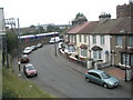
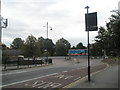
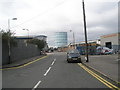
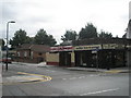
100 photos from this area
Area Information
Key information about the UB2 5BB including its size, population, and administrative classification.
- Area Type
- Postcode
- Area Size
- 1.4 hectares
- Population
- 2078
- Population Density
- 13546 people/km²
House Prices in UB2 5BB
23
Properties
£230,100
Average Sold Price
£59,000
Lowest Price
£445,000
Highest Price
Showing 23 properties
| Address | Type | Beds | Baths | Last Sale Price | Last Sale Date | |
|---|---|---|---|---|---|---|
| 17 Gladstone Road, Southall, UB2 5BB | Terraced | 3 | 1 | £445,000 | Mar 2025 | |
| 27 Gladstone Road, Southall, UB2 5BB | Terraced | 3 | 2 | £420,000 | Dec 2024 | |
| 29 Gladstone Road, Southall, UB2 5BB | Terraced | 4 | 2 | £271,000 | Jun 2014 | |
| 31 Gladstone Road, Southall, UB2 5BB | Terraced | 3 | 1 | £235,000 | Jan 2014 | |
| 1 Gladstone Road, Southall, UB2 5BB | Terraced | 3 | - | £215,000 | Dec 2013 | |
| 25 Gladstone Road, Southall, UB2 5BB | Terraced | 3 | 2 | £224,000 | May 2013 | |
| 21 Gladstone Road, Southall, UB2 5BB | Terraced | 3 | 2 | £176,000 | Sep 2003 | |
| 15 Gladstone Road, Southall, UB2 5BB | house | - | - | £186,000 | Jul 2003 | |
| 13 Gladstone Road, Southall, UB2 5BB | house | 3 | - | £70,000 | Apr 1999 | |
| 11 Gladstone Road, Southall, UB2 5BB | Terraced | 3 | 1 | £59,000 | Nov 1996 |
Page 1 of 3
Energy Efficiency in UB2 5BB
Amenities
Schools
| Rank | School | Type | Entry gender | Ages |
|---|
Explore more schools in this area
Go to Schools tabDemographics
Household Size
Family (3-5 people)
most common
Accommodation Type
Houses
most common
Tenure
48
majority
Ethnic Group
asian_total
most common
Religion
N/A
most common
Household Composition
N/A
most common
Age
47
median
Adults (30-64 years)
most common
Household Deprivation
N/A
with no deprivation
NS-SEC
14
in Lower managerial occupations
Explore more demographic insights in this area
Go to Demographics tabPlanning
Planning Constraints
- Flood RiskPremium
- Ramsar Wetland SitesPremium
- Area of Outstanding Natural BeautyPremium
- Protected Nature ReservePremium
- Protected WoodlandPremium