Area Overview for UB2 4RS
Photos of UB2 4RS
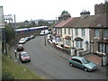
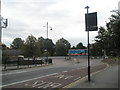
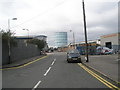
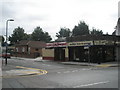
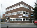
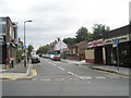
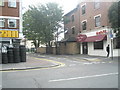
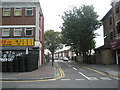
100 photos from this area
Area Information
Key information about the UB2 4RS including its size, population, and administrative classification.
- Area Type
- Postcode
- Area Size
- 2.2 hectares
- Population
- 2465
- Population Density
- 8857 people/km²
House Prices in UB2 4RS
46
Properties
£218,738
Average Sold Price
£139,950
Lowest Price
£270,000
Highest Price
Showing 46 properties
| Address | Type | Beds | Baths | Last Sale Price | Last Sale Date | |
|---|---|---|---|---|---|---|
| 127 Hunt Road, Southall, UB2 4RS | Flat | 3 | 1 | £270,000 | Oct 2023 | |
| 81 Hunt Road, Southall, UB2 4RS | Maisonette | - | - | £250,000 | May 2021 | |
| 119 Hunt Road, Southall, UB2 4RS | Flat | - | - | £215,000 | Nov 2016 | |
| 95 Hunt Road, Southall, UB2 4RS | Flat | - | - | £139,950 | Oct 2007 | |
| 111 Hunt Road, Southall, UB2 4RS | Flat | 3 | 1 | - | - | |
| 103 Hunt Road, Southall, UB2 4RS | Terraced | 3 | 1 | - | - | |
| 75 Hunt Road, Southall, UB2 4RS | Flat | - | - | - | - | |
| 133 Hunt Road, Southall, UB2 4RS | Flat | - | - | - | - | |
| 125 Hunt Road, Southall, UB2 4RS | Flat | 2 | 2 | - | - | |
| 117 Hunt Road, Southall, UB2 4RS | Maisonette | - | - | - | - |
Page 1 of 5
Energy Efficiency in UB2 4RS
Amenities
Schools
| Rank | School | Type | Entry gender | Ages |
|---|
Explore more schools in this area
Go to Schools tabDemographics
Household Size
Family (3-5 people)
most common
Accommodation Type
Flats
most common
Tenure
26
majority
Ethnic Group
asian_total
most common
Religion
N/A
most common
Household Composition
N/A
most common
Age
47
median
Adults (30-64 years)
most common
Household Deprivation
N/A
with no deprivation
NS-SEC
14
in Lower managerial occupations
Explore more demographic insights in this area
Go to Demographics tabPlanning
Planning Constraints
- Flood RiskPremium
- Ramsar Wetland SitesPremium
- Area of Outstanding Natural BeautyPremium
- Protected Nature ReservePremium
- Protected WoodlandPremium