Area Overview for UB2 4LN
Photos of UB2 4LN
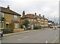
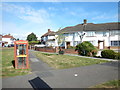
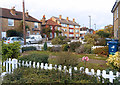
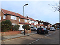

56 photos from this area
Area Information
Key information about the UB2 4LN including its size, population, and administrative classification.
- Area Type
- Postcode
- Area Size
- 5.9 hectares
- Population
- 1800
- Population Density
- 3668 people/km²
House Prices in UB2 4LN
17
Properties
£556,607
Average Sold Price
£130,000
Lowest Price
£1,500,000
Highest Price
Showing 17 properties
| Address | Type | Beds | Baths | Last Sale Price | Last Sale Date | |
|---|---|---|---|---|---|---|
| 79 Tentelow Lane, Southall, UB2 4LN | Bungalow | - | - | £1,500,000 | Feb 2025 | |
| 75 Tentelow Lane, Southall, UB2 4LN | Bungalow | 2 | 1 | £575,000 | Mar 2019 | |
| 73 Tentelow Lane, Southall, UB2 4LN | Flat | 1 | 1 | £560,000 | Mar 2018 | |
| 89 Tentelow Lane, Southall, UB2 4LN | Detached | 6 | 4 | £171,250 | Apr 2004 | |
| 87 Tentelow Lane, Southall, UB2 4LN | Terraced | - | - | £570,000 | Nov 2002 | |
| 63 Tentelow Lane, Southall, UB2 4LN | Flat | 3 | 1 | £390,000 | May 2002 | |
| 81 Tentelow Lane, Southall, UB2 4LN | Semi-detached | - | - | £130,000 | Jun 1996 | |
| 77 Tentelow Lane, Southall, UB2 4LN | Bungalow | 3 | 2 | - | - | |
| 61 Tentelow Lane, Southall, UB2 4LN | Semi-detached | 2 | 1 | - | - | |
| 69 Tentelow Lane, Southall, UB2 4LN | Terraced | - | - | - | - |
Page 1 of 2
Energy Efficiency in UB2 4LN
Amenities
Schools
| Rank | School | Type | Entry gender | Ages |
|---|
Explore more schools in this area
Go to Schools tabDemographics
Household Size
Family (3-5 people)
most common
Accommodation Type
Houses
most common
Tenure
71
majority
Ethnic Group
asian_total
most common
Religion
N/A
most common
Household Composition
N/A
most common
Age
47
median
Adults (30-64 years)
most common
Household Deprivation
N/A
with no deprivation
NS-SEC
31
in Lower managerial occupations
Explore more demographic insights in this area
Go to Demographics tabPlanning
Planning Constraints
- Flood RiskPremium
- Ramsar Wetland SitesPremium
- Area of Outstanding Natural BeautyPremium
- Protected Nature ReservePremium
- Protected WoodlandPremium