Area Overview for UB2 4HG
Photos of UB2 4HG
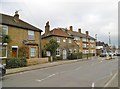
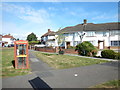
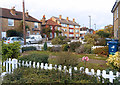
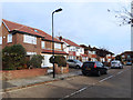

56 photos from this area
Area Information
Key information about the UB2 4HG including its size, population, and administrative classification.
- Area Type
- Postcode
- Area Size
- 6607 m²
- Population
- 1800
- Population Density
- 3668 people/km²
House Prices in UB2 4HG
17
Properties
£450,041
Average Sold Price
£106,500
Lowest Price
£770,000
Highest Price
Showing 17 properties
| Address | Type | Beds | Baths | Last Sale Price | Last Sale Date | |
|---|---|---|---|---|---|---|
| 35 Dorset Avenue, Southall, UB2 4HG | Semi-detached | 3 | 1 | £770,000 | Feb 2024 | |
| 33 Dorset Avenue, Southall, UB2 4HG | house | - | - | £670,000 | Mar 2022 | |
| 28 Dorset Avenue, Southall, UB2 4HG | house | - | - | £675,000 | Jan 2021 | |
| 31 Dorset Avenue, Southall, UB2 4HG | Semi-detached | 5 | 2 | £765,000 | Sep 2017 | |
| 22 Dorset Avenue, Southall, UB2 4HG | Semi-detached | 1 | 1 | £685,000 | Nov 2016 | |
| 23 Dorset Avenue, Southall, UB2 4HG | Detached | 7 | 4 | £495,000 | Jan 2012 | |
| 32 Dorset Avenue, Southall, UB2 4HG | house | - | - | £229,950 | May 2002 | |
| 30 Dorset Avenue, Southall, UB2 4HG | Semi-detached | 4 | 2 | £238,000 | Mar 2002 | |
| 20 Dorset Avenue, Southall, UB2 4HG | Detached | 3 | 2 | £175,000 | Jul 1999 | |
| 26 Dorset Avenue, Southall, UB2 4HG | Terraced | - | - | £141,000 | Oct 1997 |
Page 1 of 2
Energy Efficiency in UB2 4HG
Amenities
Schools
| Rank | School | Type | Entry gender | Ages |
|---|
Explore more schools in this area
Go to Schools tabDemographics
Household Size
Family (3-5 people)
most common
Accommodation Type
Houses
most common
Tenure
71
majority
Ethnic Group
asian_total
most common
Religion
N/A
most common
Household Composition
N/A
most common
Age
47
median
Adults (30-64 years)
most common
Household Deprivation
N/A
with no deprivation
NS-SEC
31
in Lower managerial occupations
Explore more demographic insights in this area
Go to Demographics tabPlanning
Planning Constraints
- Flood RiskPremium
- Ramsar Wetland SitesPremium
- Area of Outstanding Natural BeautyPremium
- Protected Nature ReservePremium
- Protected WoodlandPremium