Area Overview for UB2 4EG
Photos of UB2 4EG
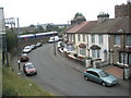
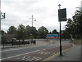
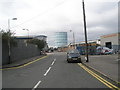
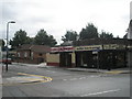
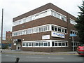
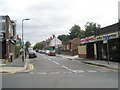
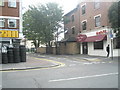
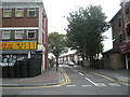
100 photos from this area
Area Information
Key information about the UB2 4EG including its size, population, and administrative classification.
- Area Type
- Postcode
- Area Size
- 9165 m²
- Population
- 2064
- Population Density
- 13751 people/km²
House Prices in UB2 4EG
65
Properties
£234,646
Average Sold Price
£42,000
Lowest Price
£563,200
Highest Price
Showing 65 properties
| Address | Type | Beds | Baths | Last Sale Price | Last Sale Date | |
|---|---|---|---|---|---|---|
| 28 Hammond Road, Southall, UB2 4EG | house | 1 | 1 | £430,000 | Jul 2025 | |
| 22 Hammond Road, Southall, UB2 4EG | Terraced | 3 | 2 | £467,000 | Jan 2024 | |
| 20 Hammond Road, Southall, UB2 4EG | Terraced | 3 | 1 | £515,000 | Oct 2022 | |
| 37 Hammond Road, Southall, UB2 4EG | Terraced | 3 | 1 | £450,000 | Feb 2022 | |
| 15 Hammond Road, Southall, UB2 4EG | house | - | - | £440,000 | Nov 2020 | |
| 18 Hammond Road, Southall, UB2 4EG | Terraced | 3 | 2 | £355,000 | Nov 2019 | |
| 35 Hammond Road, Southall, UB2 4EG | house | 3 | 1 | £274,950 | Oct 2014 | |
| 39 Hammond Road, Southall, UB2 4EG | Terraced | 3 | 1 | £245,000 | Aug 2013 | |
| 4 Hammond Road, Southall, UB2 4EG | house | - | - | £211,000 | Jun 2013 | |
| 5 Hammond Road, Southall, UB2 4EG | house | - | - | £180,000 | Sep 2011 |
Page 1 of 7
Energy Efficiency in UB2 4EG
Amenities
Schools
| Rank | School | Type | Entry gender | Ages |
|---|
Explore more schools in this area
Go to Schools tabDemographics
Household Size
Family (3-5 people)
most common
Accommodation Type
Houses
most common
Tenure
37
majority
Ethnic Group
asian_total
most common
Religion
N/A
most common
Household Composition
N/A
most common
Age
47
median
Adults (30-64 years)
most common
Household Deprivation
N/A
with no deprivation
NS-SEC
13
in Lower managerial occupations
Explore more demographic insights in this area
Go to Demographics tabPlanning
Planning Constraints
- Flood RiskPremium
- Ramsar Wetland SitesPremium
- Area of Outstanding Natural BeautyPremium
- Protected Nature ReservePremium
- Protected WoodlandPremium