Area Overview for UB10 9LE
Photos of UB10 9LE
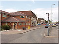
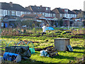

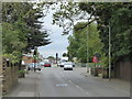

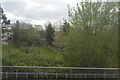


28 photos from this area
Area Information
Key information about the UB10 9LE including its size, population, and administrative classification.
- Area Type
- Postcode
- Area Size
- 3.6 hectares
- Population
- 1467
- Population Density
- 2497 people/km²
House Prices in UB10 9LE
28
Properties
£832,066
Average Sold Price
£175,250
Lowest Price
£1,240,000
Highest Price
Showing 28 properties
| Address | Type | Beds | Baths | Last Sale Price | Last Sale Date | |
|---|---|---|---|---|---|---|
| 30 Sweetcroft Lane, Uxbridge, UB10 9LE | Detached | 4 | 3 | £1,240,000 | Jan 2024 | |
| 40 Sweetcroft Lane, Uxbridge, UB10 9LE | house | - | - | £1,223,000 | Aug 2021 | |
| 47 Sweetcroft Lane, Uxbridge, UB10 9LE | Detached | 5 | 3 | £1,180,000 | Aug 2021 | |
| 43 Sweetcroft Lane, Uxbridge, UB10 9LE | Bungalow | 3 | 2 | £700,000 | Mar 2021 | |
| 45A Sweetcroft Lane, Uxbridge, UB10 9LE | Bungalow | 3 | 2 | £940,000 | Feb 2020 | |
| 28 Sweetcroft Lane, Uxbridge, UB10 9LE | Detached | 4 | 3 | £1,000,000 | Feb 2020 | |
| Ilford Homes, Sweetcroft Residential Care Home, 53 Sweetcroft Lane, Uxbridge, UB10 9LE | hospital_care_home | - | - | £1,185,000 | Sep 2019 | |
| 51 Sweetcroft Lane, Uxbridge, UB10 9LE | Detached | 4 | - | £1,075,000 | Mar 2018 | |
| 36 Sweetcroft Lane, Uxbridge, UB10 9LE | house | - | - | £875,000 | Jul 2016 | |
| 50 Sweetcroft Lane, Uxbridge, UB10 9LE | house | - | - | £1,225,000 | Mar 2016 |
Page 1 of 3
Energy Efficiency in UB10 9LE
Amenities
Schools
| Rank | School | Type | Entry gender | Ages |
|---|
Explore more schools in this area
Go to Schools tabDemographics
Household Size
Family (3-5 people)
most common
Accommodation Type
Houses
most common
Tenure
82
majority
Ethnic Group
White
most common
Religion
N/A
most common
Household Composition
N/A
most common
Age
47
median
Adults (30-64 years)
most common
Household Deprivation
N/A
with no deprivation
NS-SEC
42
in Lower managerial occupations
Explore more demographic insights in this area
Go to Demographics tabPlanning
Planning Constraints
- Flood RiskPremium
- Ramsar Wetland SitesPremium
- Area of Outstanding Natural BeautyPremium
- Protected Nature ReservePremium
- Protected WoodlandPremium