Area Overview for UB10 9BA
Photos of UB10 9BA
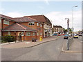
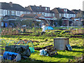
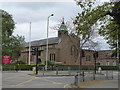
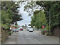
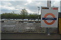
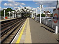
28 photos from this area
Area Information
Key information about the UB10 9BA including its size, population, and administrative classification.
- Area Type
- Postcode
- Area Size
- 6993 m²
- Population
- 1784
- Population Density
- 6607 people/km²
House Prices in UB10 9BA
18
Properties
£456,304
Average Sold Price
£219,000
Lowest Price
£620,000
Highest Price
Showing 18 properties
| Address | Type | Beds | Baths | Last Sale Price | Last Sale Date | |
|---|---|---|---|---|---|---|
| 118 Windsor Avenue, Uxbridge, UB10 9BA | Terraced | 3 | 2 | £515,000 | Sep 2023 | |
| 116 Windsor Avenue, Uxbridge, UB10 9BA | Terraced | 3 | 1 | £474,950 | May 2023 | |
| 149 Windsor Avenue, Uxbridge, UB10 9BA | house | 3 | 1 | £500,000 | Jan 2023 | |
| 157 Windsor Avenue, Uxbridge, UB10 9BA | house | - | - | £535,000 | Jan 2022 | |
| 161 Windsor Avenue, Uxbridge, UB10 9BA | Semi-detached | 3 | - | £620,000 | Aug 2021 | |
| 104 Windsor Avenue, Uxbridge, UB10 9BA | Flat | - | - | £516,000 | Jun 2021 | |
| 155 Windsor Avenue, Uxbridge, UB10 9BA | house | - | - | £470,000 | Apr 2021 | |
| 106 Windsor Avenue, Uxbridge, UB10 9BA | house | - | - | £450,000 | Apr 2021 | |
| 145 Windsor Avenue, Uxbridge, UB10 9BA | Flat | 3 | 1 | £455,000 | Jul 2018 | |
| 108 Windsor Avenue, Uxbridge, UB10 9BA | Semi-detached | 3 | - | £450,000 | Jun 2017 |
Page 1 of 2
Energy Efficiency in UB10 9BA
Amenities
Schools
| Rank | School | Type | Entry gender | Ages |
|---|
Explore more schools in this area
Go to Schools tabDemographics
Household Size
Family (3-5 people)
most common
Accommodation Type
Houses
most common
Tenure
76
majority
Ethnic Group
White
most common
Religion
N/A
most common
Household Composition
N/A
most common
Age
47
median
Adults (30-64 years)
most common
Household Deprivation
N/A
with no deprivation
NS-SEC
35
in Lower managerial occupations
Explore more demographic insights in this area
Go to Demographics tabPlanning
Planning Constraints
- Flood RiskPremium
- Ramsar Wetland SitesPremium
- Area of Outstanding Natural BeautyPremium
- Protected Nature ReservePremium
- Protected WoodlandPremium